 |
READING HALLTHE DOORS OF WISDOM |
 |
 |
 |
THE HISTORY OF ANCIENT INDIACHAPTER I
THE
SUB-CONTINENT OF INDIA
THE great continent of Asia falls naturally into four
parts or subcontinents. The east drains to the Pacific, and is mainly Buddhist.
The north and west centre lie open in an arctic
direction, and during the past century were united under Russian rule. The
south-west, or Lower Asia, is the land of passage from Asia into Africa, and
from the Indian ocean to the Atlantic. It is the homeland of Islam. In the
middle south is the Indian subcontinent.
The inhabitants of the United States describe their
vast land as a sub-continent. As regards everything but mere area the
expression is more appropriate to India. A single race and a single religion
are overwhelmingly dominant in the United States, but in India a long history
lives today in the most striking contrasts, presenting all manner of problems
which it will take generations to solve.
In the past there have been great empires in India,
but it is a new thing that the entire region from the Hindu Kush to Ceylon, and
from Seistan to the Irrawaddy should be united in a
single political system. The one clear unity which India has possessed
throughout history has been geographical. In no other part of the world, unless
perhaps in South America, are the physical features on a grander scale. Yet nowhere
else are they more simply combined into a single natural region.
The object of this chapter is to give a geographical
description of India, as the foundation upon which to build the historical
chapters which follow. We will make an imaginary journey through the country,
noting the salient features of each part, and will then consider it as a whole,
in order to set the facts in perspective.
The most convenient point at which to begin is
Colombo, the strategical centre of British sea-power
in the Indian ocean. Four streams of traffic, India-bound, converge upon
Colombo from Aden and the Mediterranean, from the Cape, from Australia, and
from Singapore and the Far East. From Cape Comorin, in the immediate
neighborhood of Colombo, the Indian coasts diverge to Bombay and Karachi on the
one hand, and to Madras, Calcutta, and Rangoon on the other.
Colombo is not, however, in a technical sense Indian.
It is the chief city of the luxuriant and beautiful island of Ceylon, which is
about as large as Ireland. Neither today nor in the past has Ceylon been a mere
appendage of India. The Buddhist religion of half its population, and the Dutch
basis of its legal code are the embodiment of chapters in its history; it is
for good historical reasons that the Governor of Ceylon writes his dispatches
home to the Secretary for the Colonies and not to the Secretary for India.
The passage by steamer across the Gulf of Manaar from Colombo to Tuticorin on the mainland occupies a night. Midway on the voyage the mountains of Ceylon
lie a hundred miles to the east, and Cape Comorin a hundred miles to the west.
The gulf narrows northward to Palk Strait, which is almost closed by a chain of
islands and shoals, so that the course of ships from Aden into the Bay of
Bengal is outside Ceylon.
Cape Comorin, the southernmost point of India, lies
eight degrees north of the equator, a distance nearly equivalent to the length
of Great Britain. From Comorin the Malabar and Coromandel coasts extend for a
thousand miles, the one north-westward; and the other northward and then
north-eastward. The surf of the Arabian sea beats on the Malabar coast, that of
the Bay of Bengal on the Coromandel coast. Both the Arabian sea and the Bay of
Bengal open broadly southward to the Indian ocean, for the Indian peninsula
narrows between them to a point.
The interior of the Indian peninsula is for the most
part a low plateau, known as the Deccan, whose western edge is a steep brink
overlooking the Malabar coast. From the top of this brink, called the Western
Ghats, the surface of the plateau falls gently eastward to a lower brink, which
bears the name of Eastern Ghats. Between the Eastern Ghats and the Coromandel
coast there is a belt of lowland, the Carnatic. Thus India presents a lofty
front to the ship approaching from the west, but a featureless plain along the
Bay of Bengal, where the trees of the coastline appear to rise out of a water
horizon when seen from a short distance seaward.
As the steamer approaches Tuticorin the land becomes visible some miles to the west as a low dark line along the
horizon. Gradually the detail of the coast separates into a rich vegetation of
trees and a white city, whose most prominent object is a cotton factory. India
is a land of cotton. Its people have grown cotton, woven cotton, and worn
cotton from time immemorial. The name calico is derived from Calicut, a town on
the Malabar coast which was a centre of trade when
Europeans first came over the ocean.
Fishing village in the Tuticorin coast
On leaving Tuticorin we
travel northward over the Carnatic plain. It is a barren looking country and
dry, though at certain seasons there are plentiful rains, and crops enough are
produced to maintain a dense population.
Far down on the western horizon are the mountains of
the Malabar coast, for in this extremity of India the Western and Eastern Ghats
have come together and there is no plateau between them. The mountains rise
from the western sea and from the eastern plain into a ridge along the west
coast, with summits about as high as the summits of Ceylon, that is to say some
eight thousand feet. The westward slopes of these mountains, usually known as
the Cardamon hills, belong to the little native states
of Travancore and Cochin.
A group of hills, isolated on the plain, marks the
position of Madura, a hundred miles from Tuticorin.
Madura is one of three southern cities with superb Hindu temples. The other two
are Trichinopoly and Tanjore, standing not far from
one another, a second hundred miles on the road from Tuticorin to Madras.
A hundred and fifty miles west of Trichinopoly is Ootacamund, high on the Nilgiri hills. Ooty, as it is familiarly called, stands some
seven thousand feet above the sea in the midst of a country of rolling downs,
rising at highest to nearly nine thousand feet. This lofty district forms the
southern point of the Deccan plateau, where the Eastern and Western Ghats draw
together.
Ootocamund hills
South of the Nilgiris is one
of the most important features in the geography of Southern India. The western
mountains are here breached by the broad Gap of Coimbatore or Palghat, giving lowland access from the Carnatic plain to
the Malabar coast. The Cardamon hills face the Nilgiris across this passage, which is about twenty miles
broad from north to south, and only a thousand feet above the sea.
The significance of the Gap of Coimbatore becomes
evident when we consider the distribution of population in Southern India. For
two hundred miles south of Madras, as far as Trichinopoly and Tanjore, the Carnatic plain is densely peopled. There are
more than 400 inhabitants to the square mile. A second district of equal
density of population extends from Coimbatore through the Gap to the Malabar
coast between the ancient ports of Cochin and Calicut. There are many natural
harbors along the Malabar coast all the way from Bombay southward, but the
precipitous and forested Western Ghats impede communication with the interior.
Only from Calicut and Cochin is there an easy road to the Carnatic markets, and
this is the more important because the Coromandel coast is beaten with a great
surf and has no natural harbors.
Today there is a railway from Madras through the Gap
of Coimbatore to Cochin and Calicut, and from this railway a rack and pinion
line has been constructed up into the Nilgiri heights
to give access to the hill station of Ootacamund.
There are magnificent landscapes at the edge of the Nilgiris where the mountains descend abruptly to the plains. On the slopes are great
forests in which large game abound, such as sambar and tiger. On the heights
the vegetation is naturally different from the lowland. The cultivation of the Nilgiris is chiefly of tea and cinchona.
Hills of the Nilgiris
Northward of the Nilgiris,
on the plateau between the Ghats, is the large native state of Mysore. The
Cauvery river rises in the Western Ghats, almost within sight of the western
sea, and flows eastward across Mysore. As it descends the Eastern Ghats it
makes great falls. Then it traverses the Carnatic lowland past Trichinopoly and Tanjore to the Bay of Bengal. The falls have been
harnessed and made to supply power, which is carried electrically for nearly a
hundred miles to the Kolar goldfield.
Around the sources of the Cauvery, high in the Western
Ghats, is the little territory of Coorg, no larger than the county of Essex in
England. The best of the Indian coffee plantations are in Coorg, which is
directly under the British Raj, although administered apart from Madras. Mysore
is separated from both coasts by the British Province or Presidency of Madras,
which extends through the Gap of Coimbatore.
All the southern extremity of India, except the
greater heights, is warm at all times of the year, though the heat is never so
great as in the hot season of northern India. There is no cool season in the
south comparable with that of the north. In most parts of India there are five
cool months, October, November, December, January, and February. March, April,
and May are the hot season. The remaining four months constitute the rainy
season, when the temperature is moderated by the presence of cloud. In the
south, almost girt by the sea, some rain falls at all seasons, but along the
Malabar coast the west winds of the summer bring great rains. These winds
strike the Western Ghats and the Nilgiri hills, and
drench them with moisture, so that they are thickly forested. At this season
great waterfalls leap down the westward ravines and feed torrents which rush in
short valleys to the ocean. One of the grandest falls in the world is at Gersoppa in the north-west corner of Mysore.
Madras : Burma
The city of Madras lies low on the coast four hundred miles north of Tuticorin, but the chief military station of southern India is Bangalore on the plateau within Mysore. A hundred years ago, when Sultan Tipu of Mysore had been defeated by the British, Colonel Wellesley, afterwards the great Duke of Wellington, was appointed to command "the troops above the Ghats". The expression is a picture of the contrast between the lowland Presidency and the upland Feudal State.
Madras city, like the other seaports of modern India,
has grown from the smallest beginnings within the European period. It has now a
population of more than half a million. Until within recent years; however,
Madras had no harbor. Communication was maintained with ships in the open
roadstead by means of surf boats. Two piers have now been built out into the
sea at right angles to the shore. At their extremities they bend inward towards
one another so as to include a quadrangular space. None the less there are
times when the mighty waves sweep in through the open mouth, rendering the
harbor unsafe, so that the shipping must stand out to sea. Almost every summer
half a dozen cyclones strike the east coast of India from the Bay of Bengal.
When the Madras harbor was half completed the works were overwhelmed by a
storm, and the undertaking had to be recommenced. If we consider the surf of
the Coromandel coast, and the barrier presented by the Western Ghats behind the
Malabar coast, we have some measure of the comparative isolation of southern
India.
From the far south we cross the Bay of Bengal to the
far east of India. Burma is the newest province of the Indian Empire, if we
except subdivisions of older units.
In race, language, religion, and social customs it is
nearer to China than it is to India. In these respects it may be considered
rather the first land of the Far East than the last of India, the Middle East.
Geographically, however, Burma is in relation with the
Indian world across the Bay of Bengal, for it has a great navigable river which
drains into the Indian ocean, and not into the Pacific as do the rivers of the
neighboring countries, Siam and Annam.
Commercially it is coming every day into closer
relation with the remainder of the Indian Empire, for it is a fruitful land of
sparse population, which may perhaps be developed in the future by the surplus
labor of the Indian plains.
The approach from the sea is unimpressive, for the
shore is formed by the delta of the Irrawaddy river. The easternmost of the
channels by which that great stream enters the sea is the Rangoon river. The
city of Rangoon stands some thirty miles up this channel. The golden spire of
its great pagoda rises from among the trees on the first low hill at the edge
of the deltaic plain. Fifty years ago Rangoon was a village. Today it has a
quarter of a million people. Like the other coast towns of India and Ceylon, it
owes its greatness to the Europeans who have come over the ocean. In all the
earlier ages India looked inward, not outward.
South Rangoon
Rangoon is placed where the river makes a bend
eastward. The city lies along the north bank for some miles, to the point where
the Pegu tributary enters. Black smoke hangs over the Pegu river, for there are many rice mills with tall
chimneys along its banks. Rangoon harbor is always busy with shipping. Along
its quays are great timber yards and oil mills, for the products of Burma are
first and foremost rice, and then timber, especially great logs of teak, harder
than oak, and then petroleum. The work of the port and mills is largely in the
hands of Indians and Chinese. The Burmese are chiefly occupied with work in the
fields.
The geography of Burma is of a simple design. It
consists of four parallel ranges of mountain striking southward, and three long
intervening valleys. The easternmost range separates Burma and the drainage to
the Indian ocean from Siam and the drainage to the Pacific ocean. This great
divide is continued through the Malay peninsula almost to Singapore, only one
degree north of the equator. The westernmost range divides Burma from India
proper, and then follows the west coast of Burma to Cape Negrais.
This range is continued over the bed of the ocean, and reappears in the long
chain of the Andaman and Nicobar Islands. In its entirety it has a graceful
waving lie upon the map, curving first to the west, then to the cast, and then
again to the west. The two intervening ranges separate the Salween, Sittang, and Irrawaddy valleys.
Mandalay: Bhamo
The valley of the Salween is less deeply trenched
between its bounding ranges than are the other two, and therefore has a steeply
descending course broken by rapids, and is of small value for navigation. At
its mouth is the port of Moulmein. The valley of the Sittang,
which is a relatively short river, prolongs the upper valley of the Irrawaddy,
for the latter stream makes a westward bend at Mandalay, and passes by a transverse
gap through one of the parallel ridges. Beyond this gap it bends southward
again, accepting the direction of its tributary, the Chindwin. The railway from
Rangoon to Mandalay runs through the Sittang valley
and does not follow the Irrawaddy.
The delta of the Irrawaddy bears the name of Pegu or Lower Burma. The region round Mandalay is Upper
Burma. The coast-land beyond the westernmost of the mountain ranges is known as Arakan. The coastland south of the mouth of the
Salween, beset with an archipelago of beautiful islands, is known as Tenasserim.
The train from Rangoon to Mandalay crosses the broad
levels of the delta, passing through endless rice or 'paddy' fields. Only the
ears of the grain are lopped off; the straw is burnt as it stands. The Burmans are mostly yeomen, each owning his cattle and doing
his own work in the fields. Beyond the delta the railway follows the Sittang river, with hill ranges low on the eastern and
western horizons. At Mandalay it comes through to the Irrawaddy again.
There is a hill in the northern suburbs of Mandalay,
several hundred feet high, from which you may look over the city. Even when
seen from this height the houses are so buried in foliage that the place
appears like a wood of green trees. It has a population of about two hundred
thousand, so that it is now smaller than upstart Rangoon. Mandalay is the last
of three capitals a few miles apart, which at different times in the past
century were the seat of the Burmese kings. Amarapura,
a few miles to the south, was the capital until 1822. Ava, a few miles to the
west, was the capital from 1822 to 1837.
The navigation of the Irrawaddy extends for nine
hundred miles from the sea to Bhamo, near the border
of the Chinese Empire. As the steamer goes northward from Mandalay the banks
are at first flat, with here and there a group of white pagodas. Great rafts of
bamboo and teak logs float down the river. At Kathti the flat country is left, for the river there comes from the east through grand
defiles, with wooded fronts descending to the water's edge. Bhamo lies low along the river bank beyond the narrows. It is only twenty miles from
the Chinese frontier. Many of its houses are raised high upon piles, because of
the river floods. Until recently the Kachin hillmen often
raided the caravans passing from Bhamo into China.
To realize the antiquity and the splendor of early
Burmese civilization we must descend the Irrawaddy below Mandalay to Pagan.
There for some ten miles beside the river, and for three miles back from its
bank, are the ruins of a great capital, which flourished about the time of the
Norman Conquest of England. From the centre of the
ruined city there are pagodas and temples in every direction.
Pagan is situated in what is known as the dry belt of
Burma, the typical vegetation of which is a tall growth of cactus. In Burma the
winds of summer and autumn blow from the southwest, as they do in southern
India. They bring moisture from the sea, which falls in heavy rain on the west
side of the mountains and over the delta. At Rangoon there is an annual rainfall
of more than one hundred inches, or more than three times the rainfall of
London. At Pagan, however, lying deep in the Irrawaddy valley under the lee of
the continuous Arakan range, the rainfall is small,
as little as twenty inches in the year, and the climate is hot and evaporation
rapid.
Elsewhere in Burma are either rich crops, or the most
luxuriant forests of tall leafy trees, full of game and haunted by poisonous
snakes. Wild peacocks come from the woods to feed on the rice when it is ripe,
and tigers are not unknown in the villages. Only a few years ago a tiger was
shot on one of the ledges of the great pagoda in Rangoon. Notwithstanding the
age of its civilization Burma is still subject to a masterful nature. Moreover
civilization is confined to the immediate valleys and delta of the Irrawaddy
and Salween. On the forested hills are wild tribes, akin to the Burmese in
speech and physique—the Sham in the east, the Kachins in the north, and the Chins in the west. Burma contains but twelve million
people—Burmese, Chinese, Hindus, and the hill tribes.
From Burma the passage to Bengal is by steamer, for
the Burmese and Indian railway systems have not yet been connected. The heart
of Bengal is one of the largest deltas in the world, a great plain of moist
silt brought down by the rivers Ganges and Brahmaputra from the Himalaya
mountains. But hill country is included along the borders of the province.
Bengal
To the north the map shows the high tableland of
Tibet, edged by the Himalaya range, whose southern slopes descend steeply, but
with many foothills, to the level low-lying plains of the great rivers.
Eastward of Bengal there is a mountainous belt, rising to heights of more than
six thousand feet and densely forested, which separates the Irrawaddy valley of
Burma from the plains of India. These mountains throw out a spur westward,
which rises a little near its end into the Garo hills. The deeply trenched,
relatively narrow valley of the Brahmaputra, known as Assam, lies between the
Garo hills and the Himalayas. The southward drainage from the Garo hills forms
a deltaic plain, extending nearly to the port of Chittagong. This plain,
traversed by the Meghna river which gathers water
from the Garo and Khasi range, is continuous with the delta of Bengal proper.
To the west of Bengal is another hill spur, bearing
the name of Rajmabal, which is the north-eastern
point of the plateau of central and southern India. A broad lowland gateway is
left between the Garo and Rajmahal hills, and through
this opening the Brahmaputra and Ganges rivers turn southward and converge
gradually until they join with the Meghna to form a
vast estuary. The country west of this estuary is the Bengal delta, traversed
by many minor channels, which branch from the right bank of the Ganges before
the confluence with the Meghna.
East of the estuary is that other deltaic land whose
silt is derived from the south front of the Garo hills. It is said that the
highest rainfall in the world occurs in those hills, when the monsoon sweeps
northward from the Bay of Bengal, and blows against their face. The rainfall on
a single day in the rainy season is sometimes as great as the whole annual
rainfall of London. Little wonder that there is abundance of silt for the
formation of the fertile plains below.
The approach to the coast of Bengal, as may be
concluded from this geographical description, presents little of interest. At
the entrance to the Hooghly river, the westernmost of the deltaic channels, are
broad grey mud banks, with here and there a palm tree. From time to time, as
the ship passes some more solid ground, there are villages of thatched huts,
surrounded by tall green banana plantations.
Calcutta, the chief port and largest town of modern
India, is placed no less than eighty miles up the Hooghly on its eastern bank.
The large industrial town of Howrah stands opposite on the western bank. Not a
hill is in sight round all the horizon. Only the great dome of the post office
rises white in the sunshine. Calcutta is connected with the jute mills and
engineering works of Howrah by a single bridge. Below this bridge is the port,
always thronged with shipping.
Auguste Borget’s oil on canvas
painting ‘An Indian Mosque on the Hooghly River near Calcutta’, 1846
Calcutta has grown round Fort William as a nucleus.
The present Fort, with its outworks, occupies a space of nearly a thousand
acres on the east bank of the Hooghly below the Howrah bridge. To the north,
east, and south, forming a glacis for the fort, is a wide green plain, the Maidan, and beyond this is the city. The European quarter
lies to the east of the Malan. The government offices, and beyond them the
great native city, lie to the north. Calcutta with more than a million
inhabitants exceeds Glasgow in size, and is the second city of the British
Empire.
Three hundred miles away to the north, approached from
Calcutta by the East Bengal railway, is Darjeeling, the hill station of
Calcutta, as Ootacamund is of Madras. The railway
traverses the dead level of the plain, with its thickly set villages and
tropical vegetation. There are some seven hundred and fifty thousand villages
in India, and they contain about ninety per cent. of the total population.
The Province of Bengal has a population equal to that
of Great Britain and Ireland, but concentrated on an area less than that of
Great Britain without Ireland. Yet it contains only one great city, as
greatness of cities is measured in the British Islands.
Mid-way from Calcutta to Darjeeling the Ganges is
crossed. The passage occupies about twenty minutes from one low-lying bank to
the other. Then the journey is resumed through the rice fields, with their
clumps of graceful bamboo, until at last the hills become visible across the
northern horizon. The train runs into a belt of jungle at the foot of the first
ascent. Passengers change to a mountain railway, which carries them up the
steep front, with many a turn and twist. On the lower slopes is tall forest of
teak and other great trees, hung thickly with creepers. Presently the timber
becomes smaller, and tea plantations are passed with trim rows of green bushes.
Far below, at the foot of the steep forest, spreads to the southern horizon the
vast cultivated plain. Finally trees of the fir tribe take the place of leafy
trees, and the train attains to the sharp ridge top on which is placed
Darjeeling, a settlement of detached villas in compounds, hanging on the
slopes.
Darjeeling: Sikkim: Assam
Darjeeling is about seven thousand feet above
sea-level, on an cast and west ridge, with the plains to the south and the
gorge of the Rangit river to the north. In the early
morning, in fortunate weather, the visitor may gaze northward upon one of the
most glorious scenes in the world. Over the deep valley at his feet, still dark
in the shade, and over successive ridge tops beyond, rises the mighty snow
range of the Himalayas, fifty miles away, with the peak of Kinchinjunga,
more than five miles high, dominating the landscape.
Behind Kinchinjunga, a
little to the west, and visible from Tiger hill, near Darjeeling, though not
from Darjeeling itself, is Mount Everest, the highest mountain in the world,
more than five and a half miles high. Across the vast chasm and bare granite
summits in the foreground, the glittering wall of white mountains seems to hang
in the sky as though belonging to another world. The broad distance, and the
sudden leap to supreme height, give to the scene a mysterious and almost
visionary grandeur. It is, however, only occasionally that the culminating
peaks can be seen, for they are often veiled in cloud.
The people of Sikkim, the native state in the hills
beyond Darjeeling, are highlanders of Mongolian stock and not Indian. They are
of Buddhist religion like the Burmans, and not Hindu
or Muhammadan like the inhabitants of the plains. They are small sturdy folk,
with oblique cut eyes and a Chinese expression, and they have the easy going humourous character of the Burmans,
though not the delicacy and civilization of those inhabitants of the sunny
lowland.
It is an interesting fact that these hill people should
belong to the race which spreads over the vast Chinese Empire. That race here
advances to the last hill brinks which overlook the Indian lowland. The
political map of this part of India illustrates a parallel fact. While the
plains are administered directly by British officials, the mountain slopes
descending to them are ruled by native princes, whose territories form a strip
along the northern boundary of India. North of Assam and Bengal we have in
succession, from east to west in the belt of hill country, the lands of Bhutan,
Sikkim, and Nepal. From Nepal are recruited the Gurkha regiments of the Indian
army, the Gurkhas being a race of the same small and sturdy hill men as the
people of Sikkim. In other words, they are of a Mongoloid stock, though of
Hindu religion.
The Rangit river drains from
the hills of Darjeeling, and from the snow mountains beyond, into a tributary
of the Ganges. Several hundred such torrents burst in long succession through
deep portals in the Himalayan foot hills and feed the great rivers of the
plain. These torrents are perennial, for they originate in the melting of the
glaciers, and the Himalayan glaciers cover a vast area, being fed by the
monsoon snows. Nearly all the agricultural wealth of northern India owes its origin
to the summer or oceanic monsoon, which beats against the Himalayan mountain
edge. That edge, gracefully curving upon the map, extends through fifteen
hundred miles. The streams which descend from it in long series gather into the
rivers Brahmaputra, Ganges, and Indus.
The valley of the Brahmaputra forms the province of
Assam. Notwithstanding its vast natural resources, Assam is a country which, at
most periods of its history, has remained outside the Indian civilization. Even
today it has but a sparse population and a relatively small commercial
development, for it lies on the through road no whither. High and difficult
mountains close in the eastern end of its great valley.
The geography of Assam, though very simple, is on a
very grand scale. The Tsan-po river rises high on the
plateau of Tibet northward of Lucknow. For more than seven hundred miles it
flows eastward over the plateau in rear of the Himalayan peaks. Then it turns
sharply southward, and descends from a great height steeply through a deep
gorge, until it emerges from the mountains at a level not a thousand feet above
the sea. At this point, turning westward, it forms the Brahmaputra, “the son of
Brahma, the Creator”.
The Brahmaputra flows for four hundred and fifty miles
westward through the valley of Assam, deeply trenched between the snowy wall of
the Himalayas on the one hand and the forested mountains of the Burmese border
and the Khasi and Garo hills on the other hand.
The river rolls down the valley in a vast sheet of
water, depositing banks of silt at the smallest obstruction. Islands form and
reform, and broad channels break away from the main river in time of flood, and
there is no attempt to control them. The swamps on either hand are flooded in
the rainy season, till the lower valley is one broad shining sea, from which
the hills slope up on either side. The traffic on the river is maintained
chiefly by exports of tea and timber, and imports of rice for the laborers on
the tea estates. Some day, when great sums of money
are available for capital expenditure, the Brahmaputra will be controlled, and
Assam will become the seat of teeming production and a dense population. The
Indian Empire contains three hundred and fifteen million people, but it also
contains some of the chief virgin resources of the world.
Hindustan
Where the Brahmaputra bends southward round the foot
of the Garo hills the valley of Assam opens to the plain of Bengal. Across that
plain westward, where the Ganges makes a similar southward bend round the Rajmahal hills, Bengal merges with the great plain of
Hindustan, which extends westward and north-westward along the foot of the
Himalayas for some seven hundred miles to the point where the Jumna (YAMUNA),
westernmost of the Gangetic tributaries, leaves its mountain valley. Hindustan
begins with a breadth of about a hundred miles between the Rajmahal hills and the northern mountains, spreads gradually to a breadth of two hundred
miles from the foot hills of the Himalayas to the first rise of the Central
Indian hills, and then narrows again to a hundred miles where it merges with
the Punjab plain between the Ridge of Delhi and the Himalayas. The great river
Jumna-Ganges streams southward from the mountains across the head of the plain
to Delhi, and then gradually bends south-eastward and eastward along that edge of
the plain which is remote from the mountains, as though it were pinned against
the foot of the Central hills by the impact of the successive great tributaries
from the north. Three of these tributaries are the Upper Ganges itself, whose
confluence is at Allahabad, and the Gogra and the Gandak which enter above Patna. The Jumna-Ganges receives from the south the Chambal
and Son, long rivers but comparatively poor in water.
Access to the plains of Hindustan was formerly by the
navigation of the Ganges and its tributaries. Then the Grand Trunk Road was
made from Calcutta to Delhi. More recently the East Indian Railway has been
built from Bengal to the Punjab. Both the road and the railway avoid the great
bend round the hills by crossing the upland to the west of Rajmahal.
The road descends to the Ganges at Patna, but the railway at Benares, where it
crosses by the lowest bridge over the Ganges.
Two great provinces divide the plain of Hindustan
between them. In the east is Bihar, with its capital at Patna; in the west are
the United Provinces of Agra and Oudh with their capital at Allahabad. For
administrative purposes Bihar is now joined with Orissa, the deltaic plain of
the Mahanadi river on the coast of Bengal. A broad belt of sparsely populated
hills separates Bihar from Orissa, whereas each of these fertile lowlands opens
freely to Bengal, the one along the Ganges, and the other along the coast.
When we go from Bengal into Bihar, or from Bihar into
the United Provinces it is as though we crossed from one to another of the
great continental states of Europe. The population of Bengal is larger than
that of France. The population of Bihar and Orissa is equivalent to that of
Italy. The population of the United Provinces is nearly equal to that of Germany
since the War.
Five considerable cities focus the great population of
the United Provinces, Allahabad, Cawnpore (KAMPUR), Lucknow, Agra, and Benares (VANARASI).
Allahabad is built in the angle of confluence between the Jumna and the Ganges.
A hundred miles above Allahabad, on the right or south bank of the Ganges, is
the city of Cawnpore, and on the opposite or north bank extends the old kingdom
of Oudh, with Lucknow for its capital, situated some forty miles north-east of
Cawnpore. Agra, which gives its name to all that part of the United Provinces
which did not formerly belong to Oudh, is situated on the right or south bank
of the Jumna, a hundred and fifty miles west of Lucknow. All these distances
lie over the dead level of the plain, dusty and like a desert in the dry
season, but green and fertile after the rains. Scattered over the plain are
innumerable villages in which dwell nineteen out of twenty of the inhabitants
of the United Provinces.
Eighty miles below Allahabad, on the north bank of the
Ganges is Benares, the most sacred city of the Hindus. Benares extends for four
miles along the bank of the river, which here descends to the water with a
steep brink. Down this brink are built flights of steps known as Ghats, at the
foot of which pilgrims bathe, and dead bodies are burnt. The south bank
opposite lies low and is not sacred. The word Ghat is
identical with the name applied geographically to the west and east brinks of
the Deccan Plateau.
Cawnpore is the chief inland manufacturing city of
India, contrasted in all its ways with Benares. But none of these cities are
really great, when compared with the population of the United Provinces.
Lucknow is the largest, and has only a quarter of a million inhabitants.
Notwithstanding the great changes now in progress, India still presents in most
parts essentially the same aspect as in long past centuries.
If there be one part of India which we may think of as
the shrine of shrines in a land where religion rules all life, it is to be
found in the triangle of cities—Benares and Patna on the Ganges, and Gaya some
fifty miles south of Patna. Benares has been a focus of Hinduism from very
early times. Patna was the capital of the chief Gangetic kingdom more than two
thousand years ago when the Greek ambassador Megasthenes,
first of the westerns, travelled thus far into the east. Gaya was the spot
where Buddha, seeking to reform Hinduism some five hundred years before Christ,
obtained enlightenment, and then migrated to teach at Benares, or rather at Sarnath, now in ruins, three or four miles north of the
present Benares. The peoples of all the vast Indian and Chinese world, from
Karachi to Pekin and Tokyo, look to this little group of cities as the centre of holiness, whether they be followers of Brahma or
of Buddha.
United Provinces: Central Indian Agency
The language of the United Provinces and of
considerable districts to east, south, and west of them, is Hindi, the tongue
of modern India most directly connected with ancient Sanskrit. Hindi is now
spoken by a hundred million people in all the north centre of India. It is the language not only of Bihar and the United Provinces, but
also of Delhi and of a wide district in Central India drained by the Chambal
and Son rivers. Other tongues of similar origin are spoken in the regions
around—Bengali to the east, Marathi and Gujarati to the south-west beyond the
Ganges basin, and Punjabi to the north-west. Away to the south, beyond the
limit of the Sanskrit tongues, in the Province of Madras and neighboring areas,
are languages wholly alien from Sanskrit. They differ from Hindi, Bengali,
Marathi, Gujarati, and Punjabi much as the Turkish and Hungarian languages
differ from the group of allied Indo-European tongues spoken in Western Europe.
These southern Indian tongues are known as Dravidian. The most important of
them are Telegu, spoken by twenty millions, and Tamil
spoken by fifteen millions. The Dravidian south, however, and the Aryan north
and centre agree generally in holding some form of
Hinduism or Islam.
Within the central hills there is a wide district
drained northeastward into the Jumna-Ganges chiefly by the rivers Chambal and
Son. This district, much less fruitful than the plain of Hindustan, because
less abundantly watered, and composed of rocky ground instead of alluvium, is
ruled by native chiefs. The British suzerainty was exercised under the Viceroy
by the Central Indian Agency. Of the chiefs of Central India the most important
are Sindhia and Holkar, two
Marathas ruling Hindi populations. Sindhia's capital,
Gwalior, lies a little south of Agra. It is dominated by an isolated rock fort,
flat topped and steep sided, more than three hundred feet in height. Indore, Holkar’s capital, lies in the land of Malwa,
on high ground about the sources of the Chambal river, a considerable distance
south of Gwalior. In the neighborhood is Mhow, one of
the chief cantonments of the Indian army, placed on the high ground for
climatic reasons, like Bangalore in southern India.
The long upward slope to the Chambal headstreams ends
on the summit of the Vindhya range, a high brink facing southward. From east to
west along the foot of the Vindhya face runs the sacred river Narmada in a
deeply trenched valley. Thus the Narmada (Basin) has a course at right angles to the
northward flowing Chambal streams on the heights above. The Son river occupies
almost the same line of valley as the Narmada, but flows northeastward into
the Ganges. On the south side of the Narmada valley is the Satpura range, parallel with the Vindhya brink, and beyond this is the Tapi river,
shorter than the Narmada, but flowing westward with a course generally parallel
to that of the sacred river. The Narbada and Tapti form broad alluvial flats
before they enter the side of the shallow Gulf of Cambay. South of the Tapti
begins the Deccan Plateau.
Thus a line of hills and valleys crosses India
obliquely from Rajmahal to the Gulf of Cambay, and
divides the rivers of the Indian Upland into three systems.
North of the Vindhya brink, over an area as large as
Germany, the drainage descends northeastward to the Jumna-Ganges. Between the
Vindhya range and the edge of the Deccan Plateau are the two exceptional
rivers, Narmada and Tapti, flowing westward in deeply trenched valleys. From
the Western Ghats, and from the hills which cross India south of the Tapti and
Son to Rajmahal, three great rivers flow southward
and eastward to the Bay of Bengal—the Mahanadi, Godavari, and Krishna. The area
drained by these three streams of the plateau is a third of India.
The first 'factory' of the English East India Company
was at Surat on the lower Tapti, but Bombay, two hundred miles farther south,
long ago supplanted Surat as the chief centre of
European influence in Western India. The more northern town had an easy road of
access to the interior by the Tapti valley, but the silt at the river mouth
made it difficult of approach from the sea. Bombay offered the security of an
island, and has a magnificent harbor between the island and the mainland, far
from the mouth of any considerable stream.
Bombay (MUMBAY)
Two new facts have of recent years altered all the
relations of India with the outer world, and have vitally changed the
conditions of internal government as compared with those prevailing even as
late as the Mutiny.
The first of these facts was the opening of the Suez
Canal, and the second was the construction, and as regards main lines the
virtual completion, of the Indian railway system.
Formerly shipping came round the Cape of Good Hope,
and it was as easy to steer a course for Calcutta as for Bombay. Today only
bulky cargo is taken from Suez and Aden round the southern point of India
through the Bay of Bengal to Calcutta.
The fast mail boats run to Bombay, and thence the
railways diverge south-eastward, north-eastward, and northward to all the frontiers
of the Empire. Only the Burmese railways remain for the present a detached
system. But in regard to tonnage of traffic Calcutta is still the first port of
India, for the country which lies in rear of it—Bengal, Bihar, and the United
Provinces—contains more than a hundred million people.
From Bombay inland runs the Great Indian Peninsula
Railway. The line branches a short distance from the coast, striking on the one
hand south-eastward in the direction of Madras, and on the other hand
north-eastward in the direction of Allahabad on the East Indian Railway. Each
week, a few hours after the arrival of the mail steamer at Bombay, three
express trains leave the Victoria Station of that city. One of them is bound
south-eastward for Madras. The second runs north-eastward to Allahabad, and
then on to Howrah for Calcutta. The third also runs northeastward, but
diverges northward from the Calcutta route to Agra and Delhi. When the
Government of India is at Simla the last mentioned
train continues beyond Delhi to the foot of the mountains. The time taken to
Madras is twenty-six hours, to Calcutta thirty-six hours, and to Delhi
twenty-seven hours. Recently a more direct line has been made from Bombay to
Calcutta which does not pass through Allahabad, but through Nagpur. It
traverses a hilly country, much forested and relatively thinly peopled, in the
upper basins of the Godavari and Mahanadi rivers.
The two lines of the Great India Peninsula system
approach one another from Allahabad and from Madras at an angle. They are
carried separately down the steep mountain edge of the Deccan Plateau by two
passes, the Thalghat and the Borghat,
which have put the skill of engineers to the test. The junction is in the
narrow coastal plain at the foot of the mountains. Thence the rails pass by a
bridge over a sea strait into Salsette Island, and by
a second bridge over a second strait into Bombay
Island.
The island of Bombay is about twelve miles long from
north to south. At its southern end it projects into the southward Colaba Point and the south-westward Malabar Point, between
which, facing the open sea, is Back Bay. The harbor, set with hilly islets,
lies between Bombay and the mainland, the entry being from the south round Colaba Point. Bombay is now a very fine city, but like the
other great seaports of India, it is new—as time goes in the immemorial East.
Calcutta was already great when Bombay was but a small place, for a riverway extends through densely peopled plains for a
thousand miles inland from Calcutta, whereas the horizon of Bombay is barred
beyond the harbor by the mountain face of the Western Ghats. The real greatness
of Bombay came only with the opening of the Suez Canal, and of the railway
lines up the Borghat and the Thalghat.
The train works up the Ghats from Bombay through thick
forests, and if it be the rainy season past rushing waterfalls, until it
surmounts the brink top and comes out on to the plain of the Deccan tableland
in the relative drought of the upper climate. The Western Deccan in rear of
Bombay constitutes the Maratha country.
The Marathas are the southernmost of the peoples of
Indo-European speech in India. Their homeland on the plateau, round the city of
Poona, now forms the main portion of the Province of Bombay. The landscape of
the plateau lies widely open, studded here and there with table-topped
mountains, not unlike the kopjes of South Africa. These steep-sided isolated
mountain blocks have often served as strongholds in warfare.
South-eastward of Poona, but still on the plateau
country, is Hyderabad State, the largest native state in India. It is ruled under
British suzerainty by the Nizam. The majority of the Nizam’s subjects speak Telegu and
are of Hindu faith, but the Nizam is a Muhammadan.
Near his capital, Hyderabad, is Golconda Fort, rising above the open plateau
with flat top and cliff sides. The name of Golconda has become proverbial for
immensity of wealth. Formerly it was the Indian centre of diamond cutting and polishing.
The wide Deccan Plateau is in most parts of no great
fertility. Over large areas it is fitted rather for the pasture of horses and
cattle than for the plough. Agriculture is best in the river valleys. But there
is one large district lying on the plateau top east of Bombay, and on the hill
tops north and south of the Narmada valley which is of a most singular
fertility. The usually granitic and schistose rocks of the plateau have here
been overlaid by great sheets of basaltic lava. Detached portions of these lava
beds form the table tops of most of the kopje-like hills. The lava
disintegrates into a tenacious black soil, which does not fall into dust during
the dry season, but cracks into great blocks which remain moist. As the dry
season advances these blocks shrink, and the cracks grow broader, so that
finally it is dangerous for a horse to gallop over the plain, lest his hoof
should be caught in one of these fissures.
This remarkable earth is known as the Black Cotton
Soil. The cotton seeds are sown after the rains, and as the young plant grows a
clod of earth forms round its roots which is separated from the next similar
clod by cracks. Wheat is grown on this soil in the same manner, being sown
after the rainy season and reaped in the beginning of the hot season, so that
from beginning to end the crop is produced without exposure to rain, being
drawn up by the brilliant sunshine, and fed at the root by the moisture
preserved in the heavy soil.
Deccan Plateau
Central Provinces : Baroda State
Thus in the part of India which lies immediately east,
northeast, and north of Bombay the lowlands and the uplands are alike
fertile—the lowlands round Ahmadabad and Baroda, and in the valleys of the
Narmada and Tapti rivers, because of their alluvial soil, and the uplands round
Poona and Indore because they are clothed with the volcanic cotton soil.
The east coast of India, where it trends
north-eastward from the mouths of the Godavari river to those of the Mahanadi,
is backed by great hill and forest districts, tenanted by big game and by
uncivilized tribes of men. The Eastern Ghats are here higher than elsewhere,
and they approach near to the coast, so that their foot plain affords only a
relatively narrow selvage of populated country. Through this coastal plain the
railway is carried from Calcutta to Madras.
The reason for the primitive character of this part of
the country, and of many of the districts which extend northward through the
hills almost to the valley of the Son river, is to be found in the conditions of soil
and climate. There have been no volcanic outpourings on the gneissic and
granitic rocks hereabouts, and the summer cyclones from the Bay of Bengal
strike most frequently upon this coast and travel inland in a north-westerly
direction. Some of the Gond tribes of the forests, who may perhaps be described
as the aborigines of India, still speak tongues which appear to be older than
Dravidian. In the more fertile parts of the upper Mahanadi and Godavari basins
are comprised the Central Provinces of the direct British Raj, whose capital is
at Nagpur. The Central Provinces have an area comparable with that of Italy,
though their population is but one-third the Italian population. They must not
be confused with the Central Indian Agency.
We return to the west coast. The Bombay and Baroda
railway runs out of Bombay northward and does not ascend the Ghats, but follows
the coastal plain across the lower Tapti and Narmada, rivers to Baroda, and
thence on, across the alluvial flats of the Maki and neighboring small rivers,
to Ahmadabad. The Gaikwar of Baroda governs a small
but very rich and populous lowland. His people speak Gujarati, though the Gaikwar is a Maratha, like Sindhia and Holkar. His territories are so mixed with those
of the Bombay Presidency that the map of the plains round Ahmadabad and Baroda
city is like that part of Scotland which is labeled Ross and Cromarty.
Ahmadabad was once the most important Muhammadan city of Western India, and
contains many fine architectural monuments, surpassed only by those of the
great. Mughal capitals, Delhi and Agra.
Westward of the alluvial plains of Gujarat, and beyond
the Gulf of Cambay, is the peninsula of Kathiawar, a low plateau, lower
considerably than the Deccan, but clothed in part with similar sheets of
fertile volcanic soil. Baroda has territory in Kathiawar, as has also the
Presidency of Bombay, but in addition there are a multitude of petty chieftain
ships.
North of Kathiawar is another smaller hill district,
constituting the island of Cutch. The Rann of Cutch,
a marshy area communicating with the sea, separates the island from the
mainland. Apart from Travancore and Cochin in the far south, Kathiawar and
Cutch are the only part of India where Feudal States come down to the coast.
There are a few diminutive coastal settlements belonging to the French and
Portuguese governments, but these were too insignificant to break the general
rule that the shores of India were directly controlled by the British Raj. The
largest of the foreign European settlements was at Goa on the west coast south
of Bombay. Goa has a fine harbor but the Ghats block the roads inland.
We have now completed the itinerary of the inner parts
of India. What remains to be described is the north-western land of passage
where India merges with Iran and Turan—Persia and
Turkestan. The Himalayan barrier, and the desert plateau of Tibet in rear of
it, so shield the Indian world from the north and north-east that the medieval
Buddhist pilgrims from China to Gaya were in the habit of travelling westward
by the desert routes north of Tibet as far as the river Oxus, and then
southward over the Hindu Kush. Thus they came into India from the north-west,
having circumvented Tibet rather than cross it. Great mountain ranges
articulate with the Himalayas at their eastern end, and extend into the roots
of the peninsula of Further India. Thus the direct way from China into India by
the east is obstructed. Today as we have seen the railway systems of Burma and
India are still separate.
The centre of north-western
India is occupied by a group of large Native States, known collectively as Rajputana. Through Rajputana,
diagonally from the south-west north-eastward, there runs the range of the
Aravalli hills for a distance of fully three hundred miles. The north-eastern
extremity of the Aravallis is the Ridge of Delhi on
the Jumna river. At their southern end, but separated from the main range by a
hollow, is the isolated Mount Abu, the highest point in Rajputana,
standing up conspicuously from the surrounding plains to a height of some five
thousand feet.
East of the Aravallis, in
the basin of the Chambal tributary of the Jumna-Ganges, is the more fertile
part of Rajputana, with the cities of Jaipur, Ajmer,
Udaipur, and the old fortress of Chitor. Beyond the
Chambal river itself, but within its basin, are Gwalior and Indore, the seats
of the princes Sindhia and Holkar.
But Gwalior and Indore belong to the Central Indian Agency and not to Rajputana.
West of the Aravalli hills is the great Indian desert, prolonged seaward by the salt and partly tidal marsh of the Rann of Cutch. In oases of this desert are some of the smaller Rajput capitals,
notably Bikaner. Beyond the desert flows the great Indus river through a land
which is dry, except for the irrigated strips beside the river banks and in the
delta of Sind below Hyderabad. South of Mount Abu streams descend from the end
of the Aravalli hills to the Gulf of Cambay through the fertile lowland of
Ahmadabad, sunk like a land strait between the plateau of Kathiawar to the west
and the ends of the Vindhya, and Satpura ranges to
the east. The Aravallis are the last of the Central
Indian hills towards the north-west. Outside the Aravallis the Indus valley spreads in wide low-lying alluvial plains, like those of the
Ganges, but dry.
It would be difficult to exaggerate the importance to
India of the existence of the great desert of Rajputana.
The ocean to the south-east and south-west of the peninsula was at most times
an ample protection against overseas invasion, until the Europeans rounded the
Cape of Good Hope.
The vast length of the Himalaya, backed by the desert
plateau of Tibet, was an equal defence on the north
side. Only to the north-west does India lie relatively open to the incursions
of the warlike peoples of Western and Central Asia. It is precisely in that
direction that the Indian desert presents a waterless void extending
north-eastward from the Rann of Cutch, for some 400 miles,
with a breadth of 150 miles. In rear of the desert a minor bulwark is
constituted by the Aravalli range.
Only between the north-eastern extremity of the desert
and the foot of the Himalayas below Simla is there an
easy gateway into India. No river traverses this gateway, which is on the
divide between the systems of the Indus and the Jumna-Ganges. Delhi stands on
the west bank of the Jumna at the northern extremity of the Aravallis,
just where the invading forces from the north-west came through to the
navigable waters.
Aided by such powerful natural conditions the Rajputs—the word means "sons of princes"—were
during many centuries the defenders of India against invasion by the direct
road to Delhi. Unable at last to stem the tide of Musulman conquest, they have maintained themselves on the southern flank of the advance,
and today some of their princely families claim to trace their lineage back in
unbroken descent from ancestors before the Christian era. The descendants of
conquerors who had won their kingdoms with the sword, they remain even now
proud aristocratic clans holding a predominant position in the midst of a
population far more numerous than themselves.
Narrow gauge lines branch through Rajputana in the direction of Delhi, past the foot of Mount Abu, which rises like an
island of granite from amid the sandy desert. The top of Abu is a small rugged
plateau, measuring fourteen miles by four, in the midst of which is the Gem
Lake, a most beautiful sheet of water, set with rocky islands and overhung with
great masses of rock. The house of the Resident of Rajputana is on its shore, for Mount Abu is the centre from
which Rajputana is controlled, so far as is
necessary, by the advice of the Viceroy. The summit of Abu also bears some
famous ruins of Jain temples.
Some of the most beautiful cities of India are in Rajputana. Udaipur stands beside a lake, with its palaces
and ghats reflected in the clear waters. Ajmer, now
under direct British rule, is set in a hollow among low hills, and is
surrounded by a wall. Here also there is a lake, and upon its banks are marble
pavilions. Jaipur is a walled city, surrounded by rocky hills crowned with
forts. The streets are broad, and cross one another at right angles.
The Rajputana Agency is as
large as the whole British Isles, but it contains only about ten million
people, since a great part of it is desert. The Central Indian Agency is about
as large as England and Scotland without Wales. It has a population only a
little smaller than that of Rajputana. We may measure
the significance of the more important chiefs in these two Agencies by the fact
that Sindhia rules a country little less, either in
area or population, than the kingdom of Scotland.
The Delhi Gateway
From Rajputana we come to
Delhi, which may truly be called the historical focus of all India; for, as we
have seen, it commands the gateway which leads from the Punjab plain to
Hindustan, the plain of the Jumna and the Ganges. Here the fate of invasions
from India from the north-west has been decided. Some have either never reached
this gateway or have failed to force their way through it. The conquests of
Darius in the latter part of the sixth century BC, and of Alexander the Great
in the years 327-5 BC, were not carried beyond the Punjab plain. Such
direct influence as they exercised in modifying the character of Indian
civilization must therefore have been confined to this region. On the other
hand, the invasions which have succeeded in passing the gateway and in
effecting a permanent settlement in Hindustan have determined the history of
the whole sub-continent. These belong to two groups, the Aryan and the Musulman, distinguished by religion, language, and type of
civilization, and separated from each other by an interval of probably some two
thousand years.
For the chronology of the Aryan conquests, which may
well have extended over many generations or even centuries, we possess no
certain dates. All the knowledge which we can hope to gain of the history of
this remote period must be gleaned from the study of the ancient scriptures of
these Aryan invaders.
The course of Musulman invasion, which entailed consequences of perhaps equal importance, may be
traced with greater precision. If we reckon from the Arab conquest of Sind in
712 AD to the establishment of the Sultanate of Delhi in 1193 we shall see that
nearly five centuries elapsed before Musulman conquest spread from the confines through the Delhi gateway into the very heart
of India. During this long period it was held in check by the Rajput princes;
and their ultimate failure to impede its progress was due to internal discord
which has always been the bane of feudal confederations.
So Delhi, founded by the Rajputs in the neighborhood of Indraprastha (the modern Indarpat), the capital of the Kurus in the heroic ages celebrated in India's great epic poem, the Mahabharata,
passed into the hands of the invading Musulmans and
with it passed the predominant power in India.
What Benares, and Patna, and Gaya were and are to the
Brahman and Buddhist civilizations native to India, what Calcutta, and Madras,
and Bombay, and Karachi are to the English from over the seas, that were Delhi
and Agra to the Musulmans entering India from the
north-west.
More than three centuries and a quarter later another Musulman invasion, more effective than the former, came
into India by way of Delhi. The Mughuls or Mongols of
Central Asia had been converted to Islam, and in the time of our King Henry
VIII they refunded the Musulman power at Delhi. For a
hundred and fifty years, from the time of our Queen Elizabeth to that of our
Queen Anne, a series of Mughal emperors, from Humayun to Aurangzeb, ruled in splendid state at Delhi over the greater part of India.
Agra, a hundred miles lower down the Jumna, became a secondary or alternative
capital, and in these two cities we have today the supreme examples of
Muhammadan architectural art.
More than sixty-two millions of the Indian population
hold the faith of Islam. They are scattered all over the land, usually in a
minority, but frequently powerful, for Islam has given ruling chiefs to many
districts which are predominantly Hindu. Only in two parts of India are the Musulmans in a majority, namely in the east of Bengal about
Dacca, and in the Indus basin to the north-west. We may think of the Indus
basin—lying beyond the desert, low beneath the uplands of Afghanistan—as being
an ante-chamber to India proper. In this ante-chamber, for more than nine
hundred years the Musulmans have been a majority.
When the decay of the Mughul Empire began in the time of our Queen Anne, the chief local representatives of
the imperial rule, such as the Nizam of Hyderabad,
and the Nawabs of Bengal and Oudh, assumed an
independent position. It was with these new dynasties that the East India
Company came into conflict in the days of General Clive. Thus we may regard the
British Empire in India as having been built up from the fragments into which
the Mughal Empire broke. In one region, however, the Western Deccan, the Hindus
reasserted themselves, and there was a rival bid for empire. From the
neighborhood of Poona the Marathas conquered eastward to the borders of Bengal,
and northward to the walls of Delhi. It was the work of Lord Lake and General
Wellesley to defeat the Marathas.
North-westward of Delhi, in the gateway between the
desert and the mountains, the ground is sown over with battlefields—ancient
battlefields near the Jumna, where the incoming Musulmans overthrew the Indian resistance, and modern battlefields near the Sutlej, where
advancing British power inflicted defeat upon the Sikhs. It is by no accident
that Simla, the residence of the British Viceroy
during half the year, is placed on the Himalayan heights above this natural
seat of empire and of struggle for empire.
In the Mutiny of 1857 the Sikhs of the Punjab remained
loyal to the British rule, although they had been conquered in terrible battles
on the Sutlej less than ten years before. So it happened that some of the
British forces in the Punjab were free to march to recapture Delhi, which had
been taken by the mutineers. Thus the Indian Mutiny was overcome from two
bases; on the one hand at Lucknow and Cawnpore by an army from Calcutta and the
sea; and on the other hand at Delhi by an army advancing from the Punjab over
the track beaten by many conquerors in previous ages.
Hardwar : Nepal
The river Jumna (YAMUNA) runs past Delhi with a southward
course, and is there crossed by a great bridge, over which the East Indian
Railway runs from Delhi through the United Provinces and Bengal to Howrah,
opposite Calcutta. West of Delhi is the last spur of the Aravalli hills, the
famous Ridge of Delhi, striking north-eastward to the very bank of the river.
The city lies in the angle between the Ridge and the Jumna. To the north, in
the point of the angle, is the European quarter; in the centre is Shahjahanabad, the modern native Delhi; southward
of the modern city is Firozabad, or ancient Delhi. Between Shahjahanabad and the river is the Fort.
The plain southward of Firozabad continues to widen
between the river and the hills, and is strewn over with still more ancient
ruins. To the west of these, at the foot of the hills, and in part upon them,
is the site chosen for the new imperial capital of British India. Finally,
eleven miles south of Delhi are the buildings of the Kutb Minar, where are some of the few remains of the early
Hindu period.
A hundred miles north-north-east of Delhi is Haridwar
on the Ganges, at the point where the river leaves the last foothills of the
Himalaya and enters the plain. Hardwar is the rival of Benares as a centre of Hindu pilgrimage for the purpose of ablution in
the sacred waters. At the annual fair are gathered hundreds of thousands of
worshippers. The great day at Hardwar is near the end of March when the Hindu
year begins. Then, according to tradition, the Ganges river first appeared from
its source in the mountains. The water at Hardwar is purer than at Benares in
the plain. It flows swiftly and is as clear as crystal.
From near Darjeeling until near Haridwar the foothills
of the Himalaya for five hundred miles belong to the Gurkha kingdom of Nepal,
whose capital is Katmandu. Notwithstanding its close connection with the Indian
army, Nepal is counted as an independent state, over which British suzerainty
does not formally extend. From Haridwar, however, for seven hundred miles
north-westward to where the Indus breaks from the mountains, the foothills
belong to the Empire, and upon them stand, high above the plain, a series of
bill stations. The first of these stations is Mussoorie,
not far northward of Haridwar. Mussoorie is about a
mile above sea level. Close by, but lower down, is Dehra Wm, the headquarters
of the Gurkha Rifles. Hereabouts the Tarai, an elephant-haunted
jungle belt, follows the foothills, separating them from the cultivated plains.
A hundred miles farther along the mountain brink is Simla, the summer capital of India, high on a spur above
the divide between the Indus and the Ganges. The snow often rests on the ground
the winter at Simla.
Immediately to the north of Simla the Sutlej, tributary to the Indus, trenches a way out of the mountains, and
where it issues on to the plain is the off-take of a great system of irrigation
canals. The lowland north-westward of Delhi has a sparse rainfall, for the
monsoon has lost much of its moisture thus far north-westward from the Bay of
Bengal. As a result of the construction of the irrigation canals colonies have
been established between the Sutlej and the Jumna, and wheat is grown on
thousands of square miles that were formerly waste. India has a great
population, but with modern methods of water supply, and more advanced methods
of cultivation, there is still ample room for settlement within its boundaries.
Two Sikh Feudal States, Patiala and Nabha, are included within the area now irrigated from the
Sutlej, but Amritsar, the holy city of the Sikhs, lying beyond the Sutlej,
about two hundred and fifty miles from Delhi, is under the immediate British
Raj. Fifty miles west of Amritsar is Lahore, the old Musulman capital of the Punjab. We conquered the Punjab from the Sikhs, but for many
centuries it had been ruled by the Musulmans. In the
break-up of the Mughal Empire during the eighteenth century, invaders came from
Persia and from Afghanistan, who carried devastation even as far as Delhi. In
their wake, with relative ease, the Sikhs, contemporaries of the Marathas of
Poona, established a dominion in the helpless Punjab. They extended their rule also
into the mountains of Kashmir, north of Lahore.
The North-West Frontier
In all the British Empire there is but one land
frontier on which warlike preparation must ever be ready. It is the northwest
frontier of India. True that there is another boundary even longer, drawn
across the American continent, but there fortunately only customs-houses are
necessary, and an occasional police guard. The north-west frontier of India, on
the other hand, lies through a region whose inhabitants have been recruited
throughout the ages by invading warlike races. Except for the Gurkha
mountaineers of Nepal, the best soldiers of the Indian army are drawn from this
region, from the Rajputs, the Sikhs, the Punjabi Musulmans, the Dogra mountaineers north of the Punjab, and
the Pathan mountaineers west of the Punjab. The
provinces along this frontier, and the Afghan land immediately beyond it, are
the one region in all India from which, under some ambitious lead, the attempt
might be made to establish a fresh imperial rule by the overthrow of the
British Raj. Such is the teaching of history, and such the obvious fate of the
less warlike peoples of India, should the power of Britain be broken either by
warfare on the spot, or by the defeat of our navy. Beyond the north-west
frontier; moreover, in the remoter distance, are the continental powers of
Europe.
The Indian army and the Indian strategical railways
are therefore organized with special reference to the belt of territory which
extends north-east and south-west beyond the Indian desert, and is traversed
from end to end by the Indus river. This frontier belt divides naturally into
two parts. Inland we have the Punjab, where five rivers—the Indus, Jhelum,
Chenab, Ravi, and Sutlej—emerging from their mountain valleys, gradually close
together through the plain to form the single stream of the Lower Indus;
seaward we have Sind, where the Indus divides into distributaries forming a
delta.
Sind is a part of the Bombay Presidency, for it is
connected with Bombay by sea from the port of Karachi. Of late a railway has
been constructed from Ahmadabad, in the main territory of Bombay, across the
southern end of the desert to Hyderabad, at the head of the Indus delta. The
Punjab is a separate province, with its own lieutenant-governor at Lahore, and
a population as large as that of Spain.
To understand the significance of the north-west
frontier of India we must look far beyond the immediate boundaries of the
Empire. Persia, Afghanistan, and Baluchistan form a single plateau, not so
lofty as Tibet, but still one of the great natural features of Asia. This plateau
in its entirety is most conveniently known as Iran. On all sides the Iranian
plateau descends abruptly to lowlands or to the sea, save in the north-west,
where it rises to the greater heights of Armenia, and in the north-east, where
it rises to the lofty Pamirs. Southward and south-westward of Iran lie the
Arabian sea and the Persian gulf, and the long lowland which is traversed by
the rivers Euphrates and Tigris. Northward, to the east of the Caspian sea, is
the broad lowland of Turkestan or Turan, traversed by
the rivers Oxus and Jaxartes, draining into the sea of Aral. Eastward is the
plain of the Indus. The defence of India from
invasion depends in the first place on the maintenance of British sea-power in
the Persian gulf and the Indian ocean, and in the second place on our refusal
to allow the establishment of alien bases of power on the Iranian plateau,
especially on those parts of it which lie towards the south and east.
In the north-east corner of Iran, west of the Punjab,
a great triangular bundle of mountain ridges splays out westward and southward
from the north-east. These ridges and the intervening valleys constitute
Afghanistan. Flowing from the Afghan valleys we have on the one hand the Kabul
river, which descends eastward to the Indus, and on the other hand the greater
river Helmand, which flows south-westward into the depressed basin of Seistan in the very heart of Iran. There the Helmand
divides into many channels, forming as it were an inland delta, from which the
waters are evaporated by the hot air, for there is no opening to the sea. The
valley of the Kabul river on the one hand, and the oasis of Seistan on the other, might in the hands of an enemy become bases wherein to prepare
for the invasion of India. Therefore, without annexing this intricate and
difficult upland, we have declared it to be the policy of Britain to exclude
from Afghanistan and from Seistan all foreign powers.
There are two lines, and only two, along which warlike
invasions of N.W. India have been conducted in historical times. On the one
hand the mountains become very narrow just north of the head of the Kabul
river. There a single though lofty ridge, the Hindu Kush, is all that separates
the basin of the Oxus from that of the Indus. Low ground, raised only a few
hundred feet above the sea, is very near on the two sides of the Hindu Kush.
There are several ways into India over this great but single range and down the
Kabul valley. The most famous is known as the Khyber route, from the name of
the last defile through which the track descends into the Indian plain.
Routes leading into N. W. India
The other route of invasion lies five hundred miles
away to the west and south-west. There the Afghan mountains come suddenly to an
end, and an easy way lies round their fringe for four hundred miles over the
open plateau, from Herat to Kandahar. This way passes not far from Seistan. South-eastward of Kandahar it descends through a
mountainous district into the lowland of the Indus. This is now called the
Bolan route, from the last gorge towards India; but in ancient times the road
went farther south over the Pass. It debouches upon the plain opposite to the
great Indian desert. Therefore the Khyber route has been the more frequently
trodden, for it leads directly, between the desert and the mountains, upon the
Delhi gateway of inner India.
Another line of communication connecting India with
Persia passes through the Makran, or the barren
region lying along the coast of Baluchistan. This route was much frequented by
Arab traders in the Middle Ages; and by it at an earlier epoch Alexander the
Great led back one detachment of his forces with disastrous results. But apart
from this return march, and the Indian expeditions of Semiramis and of Cyrus which it was designed to emulate and which may or may not be
historical, this route seems not to have been followed by any of the great
invasions of India in historical times.
The practical significance of all this geography
becomes evident not only when we study the history of Ancient India but also
when we consider the modern organization of the Indian defensive forces. They
are grouped into a northern and a southern army. The northern army is
distributed from Calcutta past Allahabad and Delhi to Peshawar, the garrison
city on the frontier. All the troops stationed along this line may be regarded
as supporting the brigades on the Khyber front. The southern army is similarly
posted with reference to Quetta on the Bolan route. It is distributed through
the Bombay and Madras Presidencies, hence Quetta can be reinforced by sea
through the port of Karachi.
The conditions of the defence of India have been vitally changed by the construction of the North-Western
Railway from Karachi through the Indus basin, with branches towards the Bolan
and the Khyber. Today that defence could be conducted
over the sea directly from Britain through Karachi, so that the desert of Rajputana would lie between the defending armies and the
main community of India within.
Karachi stands at the western limit of the Indus
delta, in a position therefore comparable to that of Alexandria beside the Nile
delta. The railway keeps to the west of the river for more than three hundred
miles as far as Sukkur, where is the Lansdowne bridge, eight hundred and forty
feet long, between Sukkur and Rohri on the east bank.
This is the very heart of the rainless region of India. During twelve years
there were only six showers at Rohri. A scheme is
under consideration for damming the Indus near this point, in order that the
irrigation canals below may be fed, not only in time of flood as at present,
but in the season of low water as well.
From Sukkur a branch railway traverses the desert
northwestward to the foot of the hills below the Bolan pass. This part of the
desert occupies a re-entering angle of lowland, with the mountains of
Afghanistan to the north and those of Baluchistan to the west. On the map, the
Afghan ranges have the effect of being festooned from the Bolan eastward and
northward. The railway ascends to Quetta either by the Mushkaf valley—the actual line of the Bolan torrent having been abandoned—or by a
longer loop line, the Harnai, which runs to the Pishin valley, north of Quetta. The latter is the usual
way. By the Mushkaf route the line is carried over a
boulder-strewn plain about half a mile broad in the bottom of a gorge, with
steeply rising heights on either side. Here and there the strip of lower ground
is trenched and split by deep canyons. At first the rails follow the Mushkaf river, and the gradients are not very severe, but
once Hirok, at the source of the Bolan river, is
passed, a gradient of one in twenty-five begins, and two powerful engines are
required to drag the train up. The steep bounding ridges now close in on either
side, with cliffs rising almost perpendicularly to several hundred feet.
Occasional blockhouses high up amid the crags defend the pass.
The gradients of the Harnai route are not quite so steep as those of the Mushkaf.
Should either way be blocked or carried away by landslips or floods, the other
would be available. The Harnai line passes through
the Chappar rift, a precipitous gorge in a great mass
of limestone. The old Bolan gorge way of the caravans was dangerous because of
the sudden spates which at times filled all the bottom between the cliffs.
Quetta lies about a mile above sea-level in a small
plain, surrounded by great mountains rising to heights of two miles and more.
Irrigation works have been constructed, so that Quetta is now an oasis amid
desert mountains. It has a population of some thirty thousand. The Agent
General for British Baluchistan resides there. The town is very strongly
fortified, for it commands the railways leading from the Khojak pass down into India. Quetta and Peshawar are the twin keys of the frontier.
From Quetta there is a railway north-westward for
another hundred and twenty miles to Chaman on the
Afghan frontier, where is the last British outpost. This line pierces the Khojak ridge by a tunnel and then emerges on the open
upland plain of Iran. The rails are kept ready at Chaman for the continuation of the track to Kandahar, seventy miles further.
Plain of the Indus : Peshawar
We return to Rohri on the
Indus. The North-Western Railway now runs to the east of the river and soon
enters the Punjab. Not very long ago all this land was a desert. Today, as the
result of a great investment of British capital, irrigation works have changed
the whole aspect of the country. The plain of the Indus has become one of the
chief wheat fields of the British Empire, for wheat is the principal crop in
the Punjab, in parts of Sind, and—outside the basin of the Indus itself—in the
districts of the United Provinces which lie about Agra. The wheat production of
India on an average of years is five times as great as that of the United
Kingdom, and about half as great as that of the United States. In the three
years 1910-12 the export of wheat from India to the United Kingdom exceeded
that from the United States to the United Kingdom.
The brown waste of the plains of the Punjab becomes,
after the winter rains, a waving sea of green wheat, extending over thousands
of square miles. Far beyond the area within which the rainfall alone suffices,
the lower Punjab and the central strip of Sind have been converted into a
second Egypt.
Though the navigation of the Indus is naturally
inferior to that of the Ganges, yet communication has been maintained by boat
from the Punjab to the sea from Greek times downward. The Indus flotilla of
steamboats has however suffered fatally from the competition of the
North-Western Railway, and the wheat exported from Karachi is now almost wholly
rail-borne.
At Multan, a considerable mercantile city near the
Chenab, the railway forks to Lahore and Peshawar. From Lahore the triangle is
completed by a line to Peshawar along the foot of the mountains, past the great
military station of Rawalpindi. The lines from Lahore and Multan unite on the
east bank of the Indus, fifty miles east of Peshawar, just below the point
where the Kabul tributary enters. They cross the Indus by the bridge of Attock. Above Rawalpindi is the hill station of Murree. The
long tongues of land between the five rivers of the Punjab are known as Doabs,
a word which in Persian has the significance of Mesopotamia in Greek. Punjab
signifies the land of five rivers.
Peshawar is the capital of the North-West Frontier
Province created in 1901, a strip of hilly country beyond the Indus. Unlike its
sister Quetta, it lies in the Indian lowland at the foot of the Khyber pass. It
has about a hundred thousand inhabitants, chiefly Musulman.
In the Bazar are to be seen representatives of many Asiatic races, for Peshawar
is the market of exchange where the great road from Samarkand and Bukhara, over
the Hindu Kush and through Kabul, by the Khyber meets the road from Delhi and
Lahore, here you may buy skeins of Chinese silk, brought by the same roundabout
ways that were trodden by the Chinese pilgrims in the Middle Ages.
Jamrud, at the entrance to the Khyber, lies some nine miles
west of Peshawar. In the Sarai at Jamrud all caravans
going into India or returning to Central Asia halt for the night. The great
Bactrian camels, two-humped and shaggy, present an unwonted contrast with the
smaller Indian camels. The fort of All Masjid, nearly three thousand feet above
the sea, crowns the steep ascent to the crest of the pass. At Landi Kotal begins the descent
into Afghanistan. Thus the Khyber is a saddle in the heights, not the gorge of
a torrent as is the Bolan. The Kabul river flows through an open valley until
it nears the British frontier. Then it swerves through a precipitous chasm by a
northward loop. The road is therefore carried over the intervening mountain
spur.
The Khyber is protected by its own hill tribes,
enlisted in the Khyber Rifles. We have brought these Pathan mountaineers into the service of law and order by enrolling them in military
forces, just as the Scottish highlanders were enrolled in the British army in
the eighteenth century. The Pathans are born
fighters, They love fighting for its own sake, and many a curious tale is told
of the vendettas intermittently continued when the Khyber riflemen of Peshawar
return from time to time on furlough to their homes in the hills.
The Indus river rises, like the Brahmaputra, high on
the plateau of Tibet to the north of Benares, and flows north-westward through
the elevated valley of Leh until it reaches the 36th
parallel of latitude. There it turns south-westward and cleaves its way through
the Himalayas by the grandest gorge in the world. You may stand on the right
bank of the Indus and look across the river to where the summit of Nanga Parbat
descends by a single slope of four miles—measured vertically—to the river bank,
every yard of the drop being visible.
Within the great northward angle thus made by the
Indus is a second smaller valley amid the mountains, which is also drained
through a gorge to the Punjab. This is the famous valley of Kashmir, whose
central plain, sheltered in every direction by lofty snow-clad mountains, is a
sunny paradise of fertility. Srinagar is the capital of Kashmir, whose Maharaja
rules also over Ladakh (capital Leh)
formerly a province of Tibet.
The northernmost outposts of the Empire are in the
valleys of Gilgit and Chitral,
which diverge south-eastward and south-westward to the Indus and Kabul rivers. Enframing Gilgit and Chitral is a great angle of the loftiest mountain ridge,
which may be likened, as it appears upon the map, to a pointed roof sheltering
all India to the south. The south-eastward limb of the angle is the Karakorum
range, and the south-westward is the Hindu Kush range. The north-western
extremity of the Himalaya fits into the angle of the Karakorum and the Hindu
Kush, from which it is separated by the valleys of Leh, Gilgit, and Chitral.
The Karakorum is backed by the heights of the Tibetan
plateau, here it is true at their narrowest, but none the less almost
inaccessible, except for one or two passes at heights of 18,000 feet, which are
traversed in the summer time by a few Yak caravans. In the Karakorum is mount
Godwin Austen, second only to Everest among the mountains of the world. There
also are the largest glaciers outside the Arctic and Antarctic regions.
The Hindu Kush, notwithstanding its elevation, is in
marked contrast to the Karakorum. It is a single broad ridge, backed by no
plateau, and is notched by some relatively low passes. The ridge itself may be
crossed in a few days or even hours at heights of twelve and thirteen thousand
feet. The difficulties of access from the valley head of Kabul to the lowland
of Bactria on the Oxus lie rather in the approaches to the passes than in the
passes themselves. But human patience has in all ages succeeded in surmounting
these difficulties; and the Hindu Kush, although the natural boundary of India
north-westward, has been no effective barrier either in a military or a
commercial sense.
There is lateral communication between the Khyber and
Bolan routes outside the Indian frontier and yet within the Hindu Kush. The
route follows a chain of valleys between Kabul and Kandahar through Ghazni. Along it from Kandahar to Kabul the army of
Alexander the Great marched to his Bactrian and Indian campaigns: and it again
became famous in the last generation because of the march of General Roberts
from Kabul to the relief of Kandahar during the Afghan war of 1882. From this
Kabul-Kandahar road several passes penetrate the mountainous belt of the Indian
frontier, presenting alternative exits from the two trunk routes. But amid the
maze of mountains north of the Kabul-Kandahar line, there are no practicable
alternatives to the two ways—over the Hindu Kush and over the plateau from Seistan.
The long barrier of the Hindu Kush seems as if it were
designed by nature to be the protecting boundary of India on the northwest. It
is the scientific frontier which in the last century British policy sought in
vain to secure. At the present time it lies mostly within the "buffer
state" of Afghanistan which was created as the best alternative. But there
have been periods in history when it has formed the actual, as well as the
ideal, limit of the Indian empire. In the last quarter of the fourth century, BC,
within a few years of the departure from India of Alexander the Great, it
separated the dominions of the Maurya emperor of
India, Chandragupta, from those of Seleucus Nicator, Alexander's successor in the eastern portion of
his vast empire. In about the middle of the third century BC the Seleucid
province of Bactria, which lay immediately to the north of the Hindu Kush,
became an independent kingdom, from which, when the Maurya empire declined and the barrier was no longer adequately protected, a second
series of Greek invasions poured into India about 200 BC.
The river Indus also appears at first sight to form a
natural boundary between India and Iran; but in this case it would be more
correct historically to say that the country through which it flows has more
frequently been the cause of contention between India and Iran. The very name
India, the country of the Indus, was first known to the West as that of a
province of the Persian empire. In Herodotus, the Greek historian of the wars
between the Persian empire and Greece in the early part of the fifth century
BC, it bears its original meaning. At a later date, Greek and Roman writers, as
so often happens in geographical nomenclature, transferred the name of the best
known province to the whole country and set an example which has since been
followed universally.
Controlling Geographical Facts Thus we conclude a rapid survey of the historical and
political geography of a vast region. The south and centre of India is structurally an island, whose steep brinks, the Western and Eastern
Ghats, are continued—beyond the coastal selvage and the strip of shallow water
off shore—by renewed steep descents into the abysses of the Arabian sea and the
Bay of Bengal, two miles deep. This great island has granitic foundations,
although it is clothed in places with volcanic rocks. Its landward brinks are
marked by mount Abu, the Aravalli hills, the ridge of Delhi, and the long low
eastward curve of hills ending at Rajmahal, where the
principal coal seams of India rest on the granitic base. The salient angles at
Delhi and Rajmahal are received, at a distance, by the
great re-entering angles of the main framework of Asia, constituted by the
brink of Iran beyond the Indus, the Himalayan brink of Tibet, and the mountains
of the Burmese border. Between these rocky limits—salient on the Indian side
and reentering on the Asiatic side—extends a broad alluvial plain, two hundred
miles in average breadth, and two thousand miles long, from the mouths of the
Ganges northward to the foot of the mountains, then northwestward along that
foot to the Punjab, and then south-westward to the mouths of the Indus.
The Indian heights proper are so relatively low,
attaining to eight or nine thousand feet only in the far south, that the whole
geography of India seems to be dominated by the Himalayas. We recover our sense
of the true proportions only when we reflect that even the Himalayas are only
five or six miles high, and that India is two thousand miles long. None the
less the Himalayas and Tibet are in a very real sense the controlling fact of
Indian geography. They pierce upward through more than half the atmosphere into
highland climates, and therefore constitute for man a mighty natural boundary.
They also guide and limit the winds of the lower air, and thus govern the
Indian climate. India is an agricultural land, whose tillage is everywhere
dependent, either directly or indirectly, upon the moisture brought from the
southern ocean by the great wind swirl of the summer and autumn monsoon. That
swirl strikes the Malabar coast as a south-west wind, sweeps over Bengal as a
south wind, and drives up the Ganges plains as a south-east wind. The whole
movement is induced by suction to where the air is rising over the hot plains
of the Middle Indus. There in the summer is one of the hottest places, if not
the hottest place in the world. The winds which come down to it off the Iranian
plateau, thus completing the swirl stream off a dry land, and bring no
moisture. In the winter a dry, bright wind, the north-east monsoon, descends
from Tibet over all India. Only in the Punjab and in the far south are there
considerable winter rains. The Punjab is in Mediterranean latitudes, where it
rains in the winter.
By these physical characteristics India is made
fruitful, and is at the same time more than half isolated from the rest of the
world. The most primitive of its inhabitants are the Gonds and other tribes, who have been driven into the forest recesses of the hills
eastward of the Deccan plateau and into other regions difficult of access
throughout the sub-continent. The Dravidian languages have been preserved in
the southern promontory. The Aryan and later invaders from western and central
Asia have come from the north-west through the passage of Delhi, and have
thence dispersed south-eastward down the Ganges to Bengal, and south-westward
to the fertile Gujarati and Maratha countries. Through the eastern mountains,
which sever the Indian Empire from China, have penetrated in historical times
few great invasions; and these have not been far-reaching in their political
results. But if we may judge from the physical types and languages of the
populations, and from their social characteristics, there has been from
prehistoric times onwards a constant infiltration of Mongolian stock, not only
abundantly into Burma, and along the Tsan-po valley
to the foothills of the Himalaya, but also in lesser degree into Assam and
into the eastern parts of Bengal about Dacca.
From the days of the Greek pilot Hippalus,
the monsoons have carried some sea traffic to and fro over the Arabian sea from
the direction of Aden. Sind was raided by Muhammadans overseas. But Sind lies
outside the desert of Rajputana. The Malabar coast
long had commercial intercourse with the Nearer East, and thus indirectly with
Christendom. But the Western Ghats lie behind the Malabar coast. In the south
of India, on that coast, are two curious relics of this traffic, two small
ancient communities of Jews and of Christians. But these are exceptional. The
one gateway of India which signified, until modern times, was the north-western
land-gate. Most of the history which is to be narrated in these volumes bears,
directly or indirectly, some relation to that great geographical fact.
CHAPTER II
PEOPLES AND LANGUAGES
|
|
|
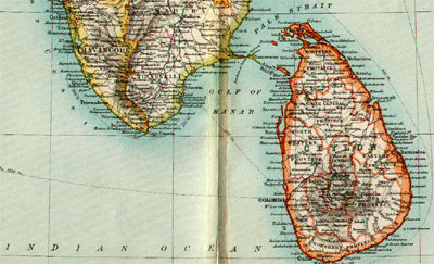
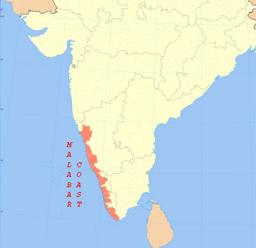
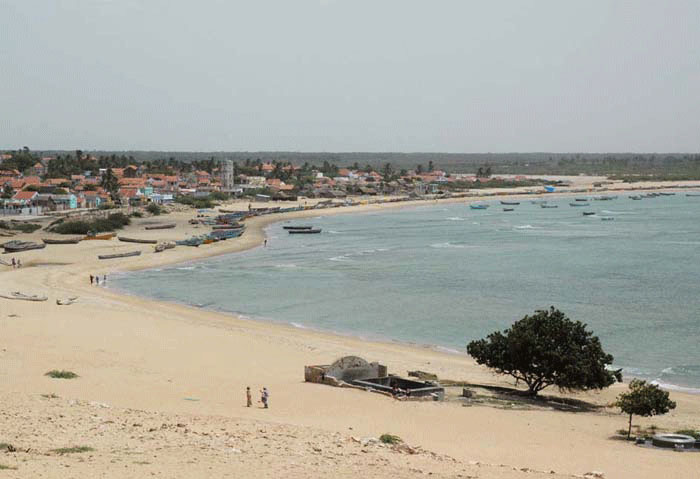
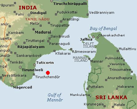
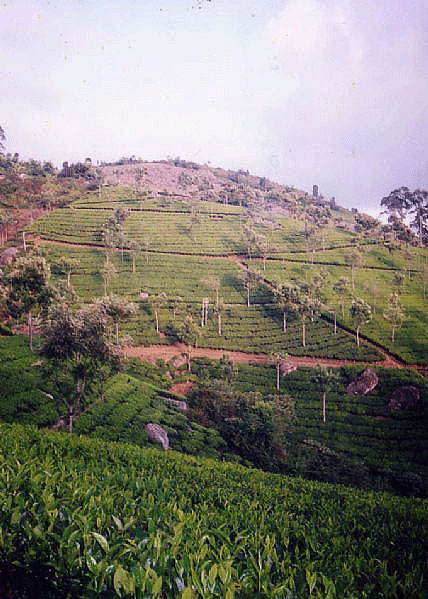
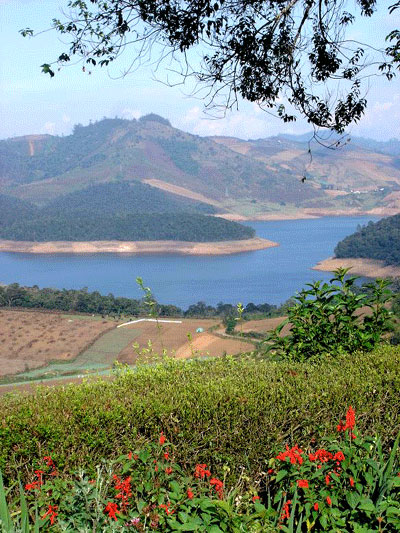
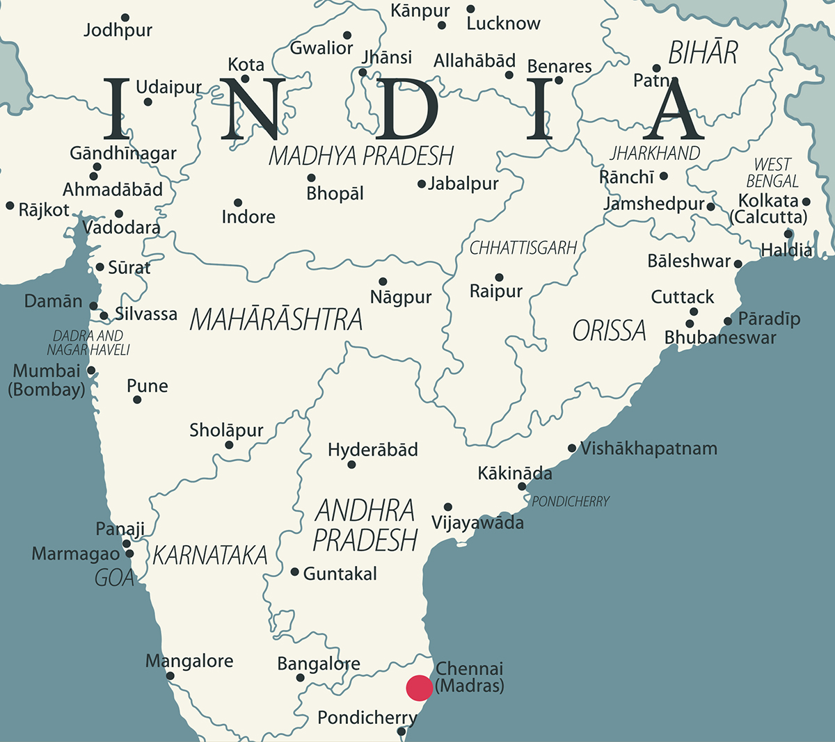
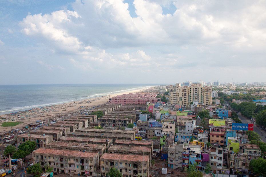

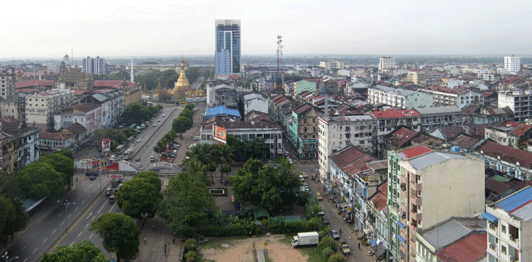
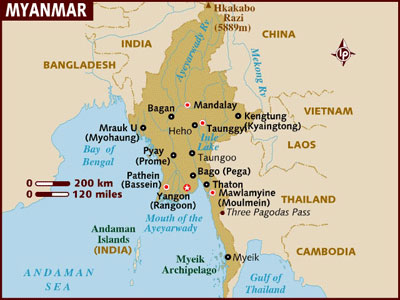

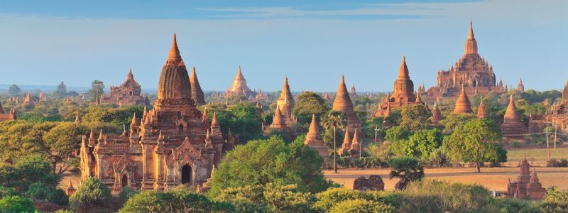
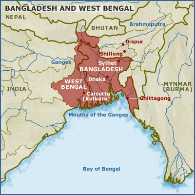
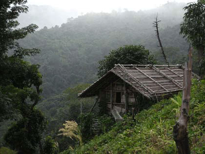
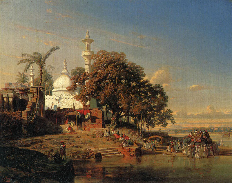
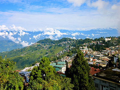
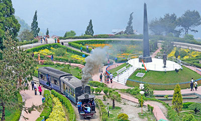

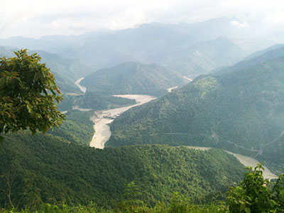
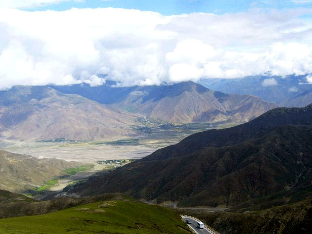
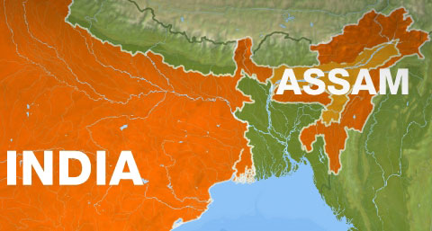
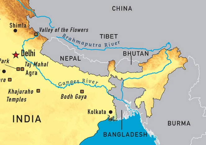
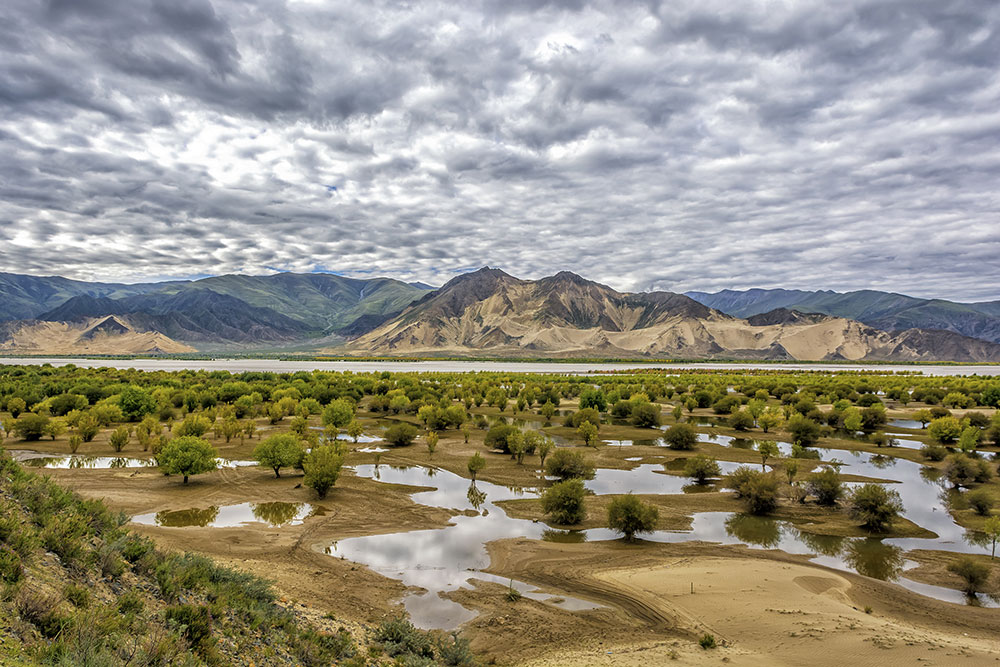
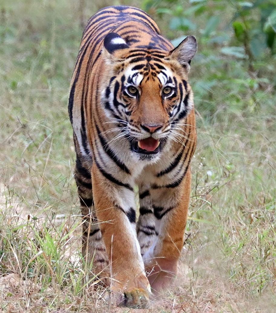
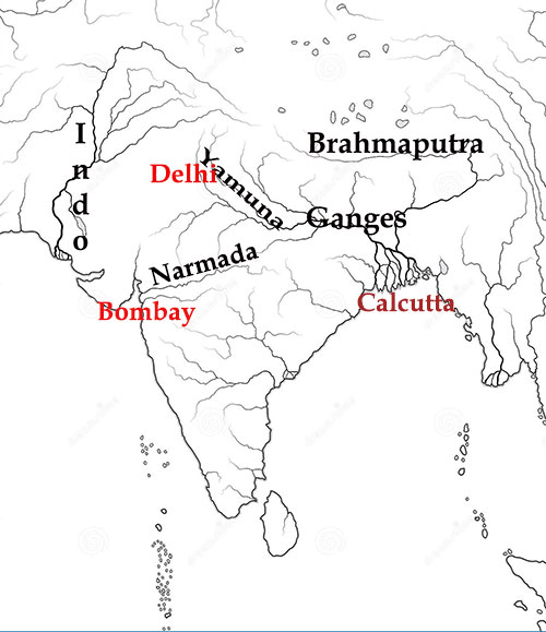
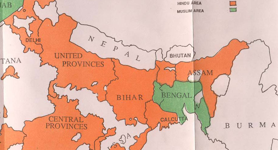
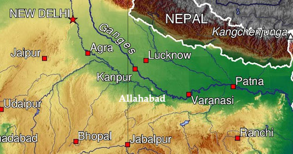
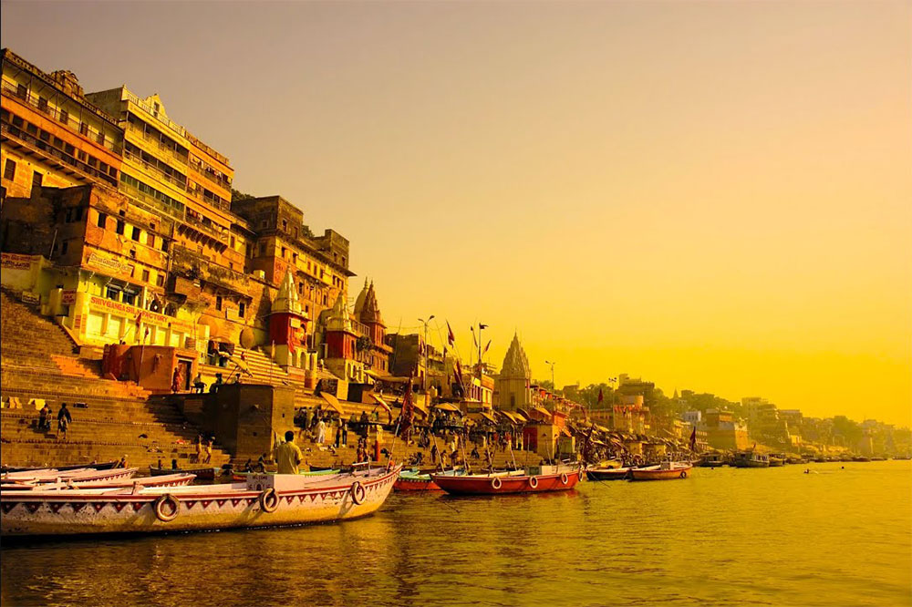
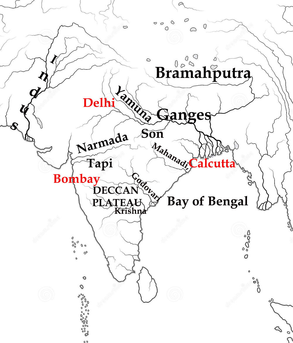
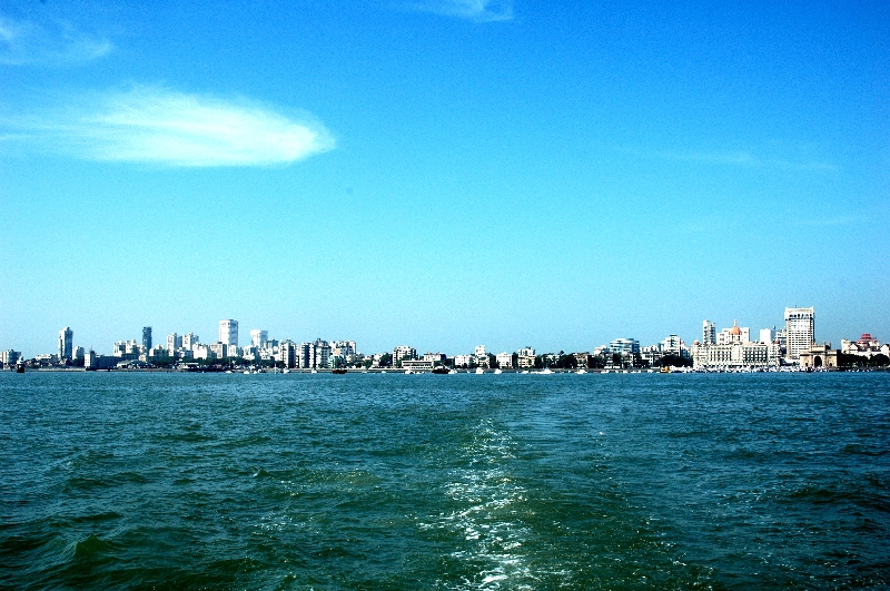


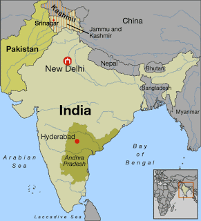
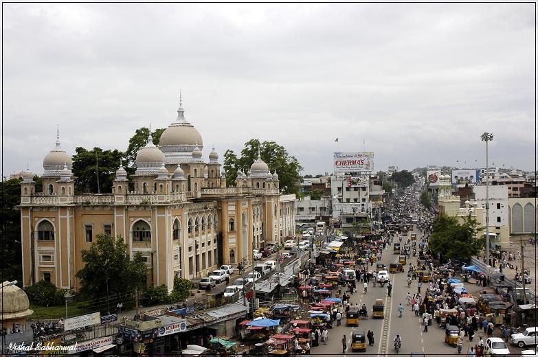
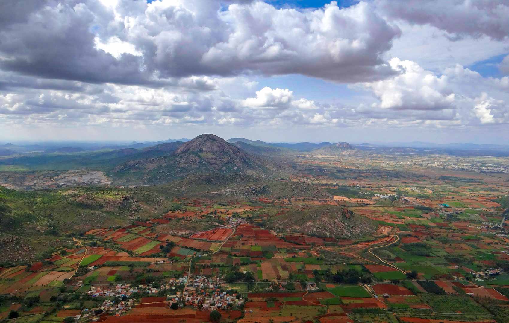

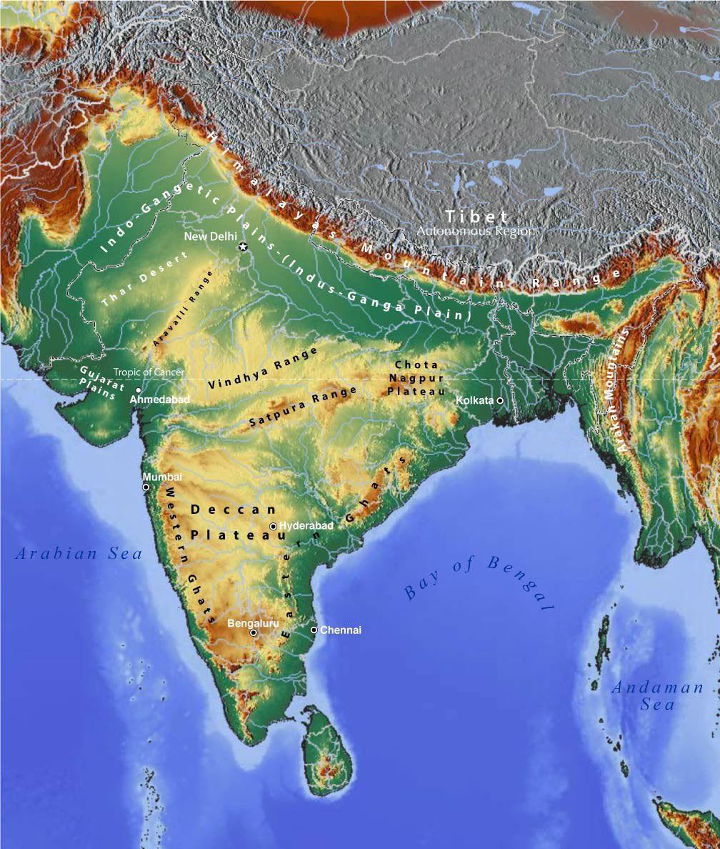
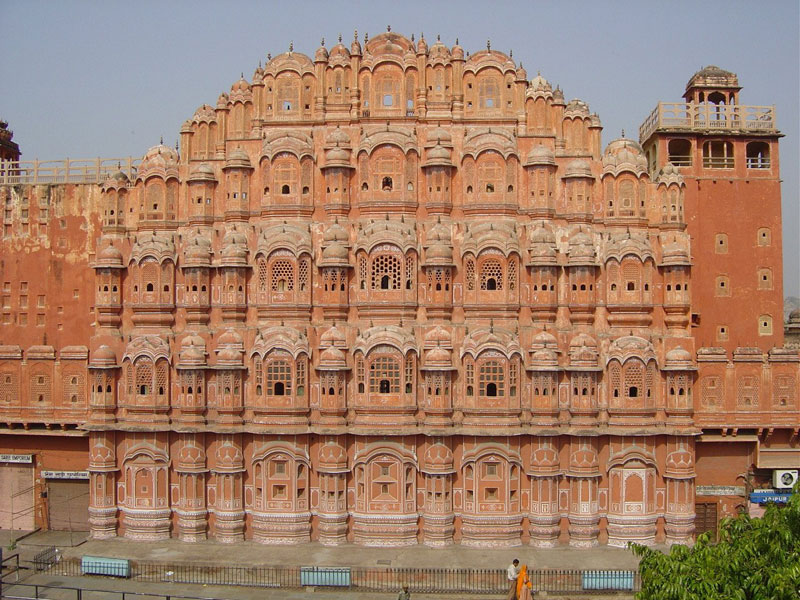
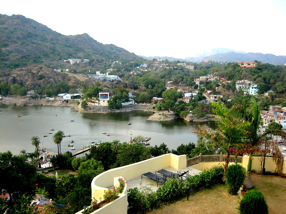
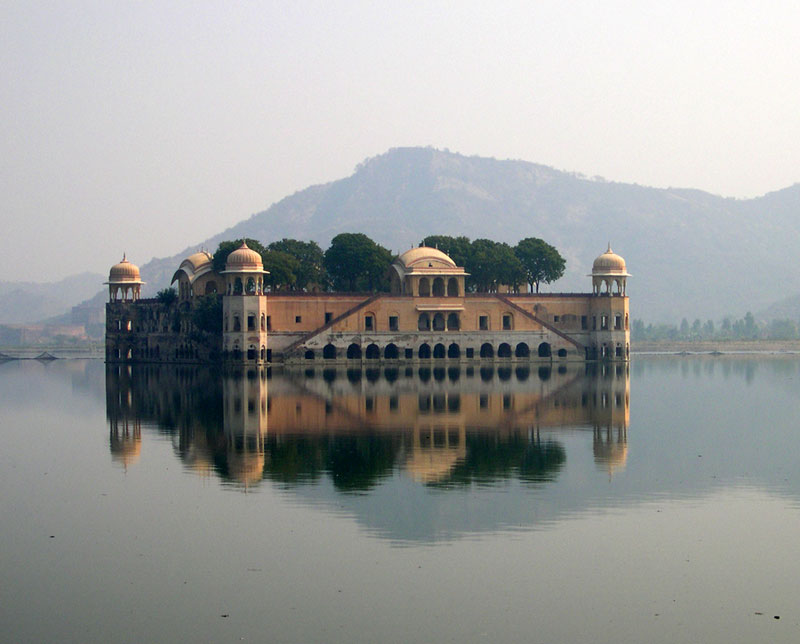
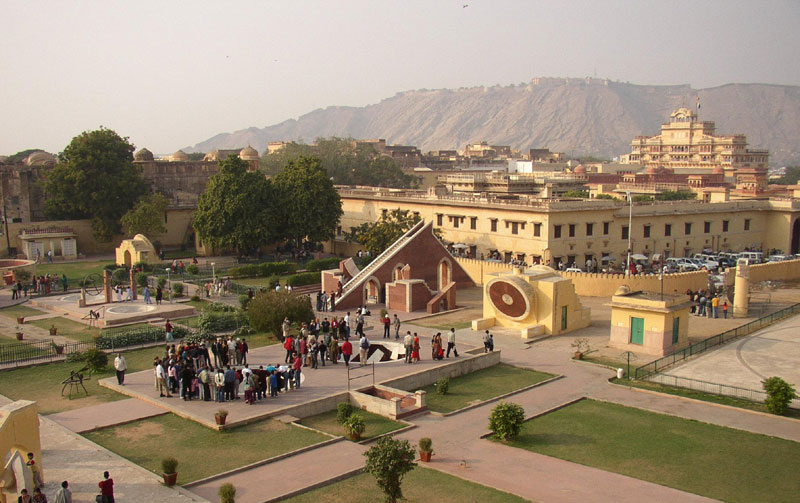
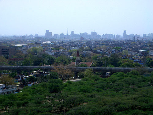
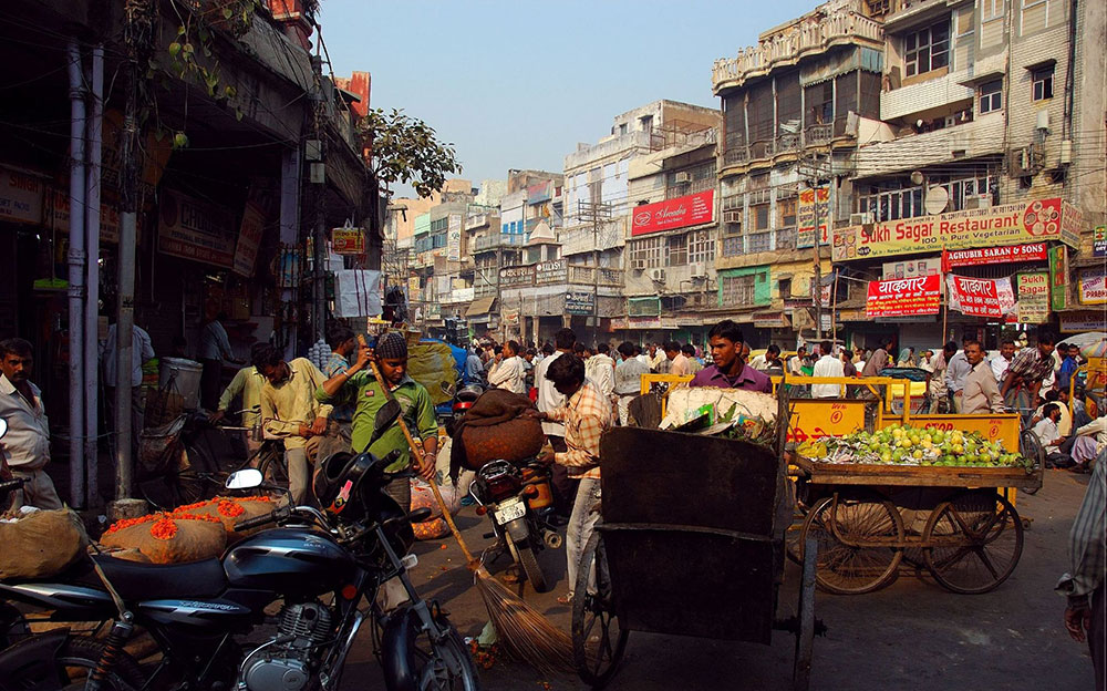
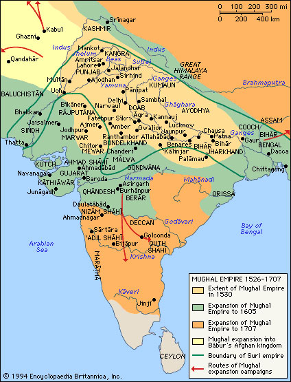
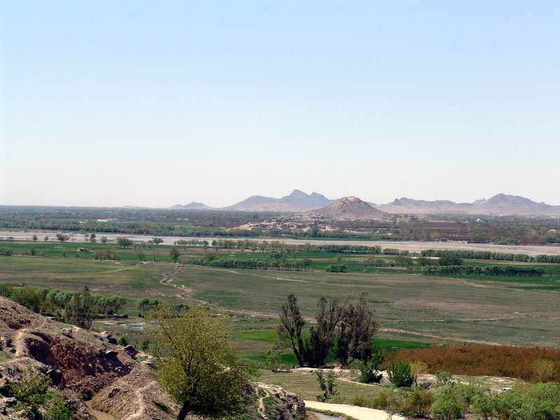
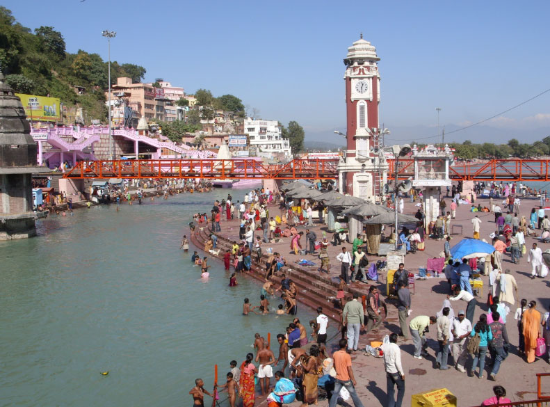
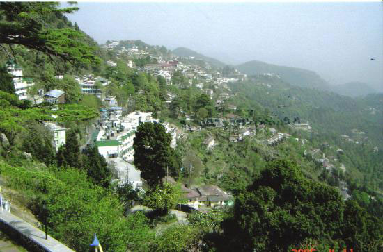
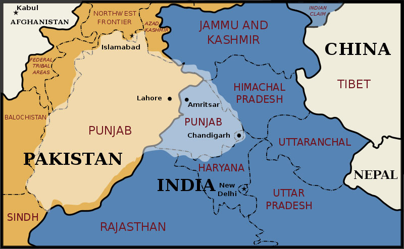
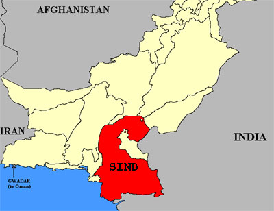
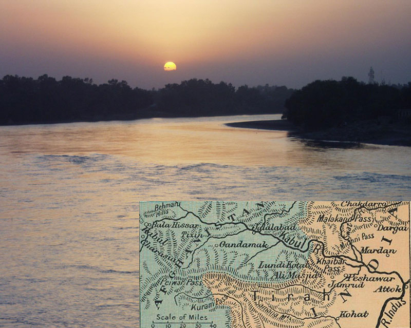
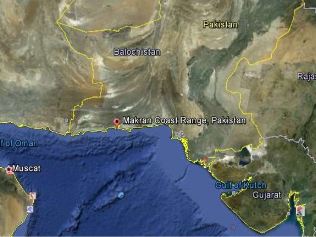
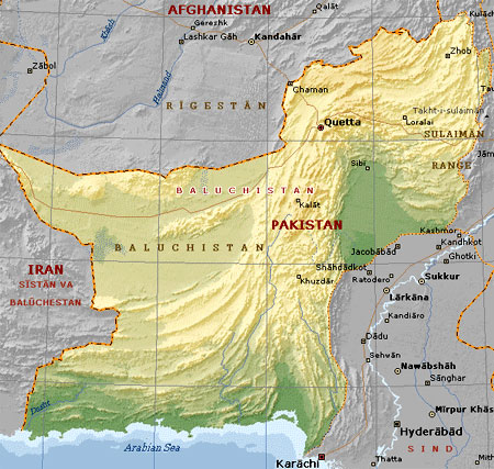
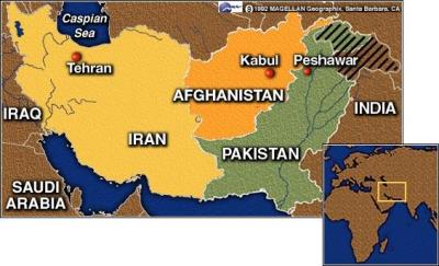
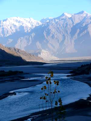
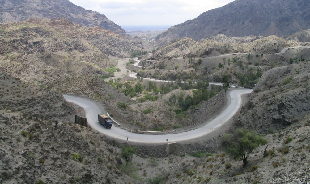
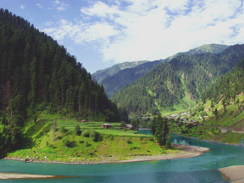
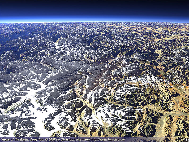
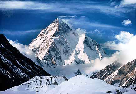
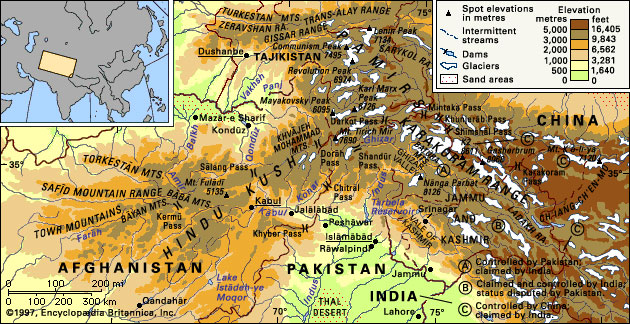
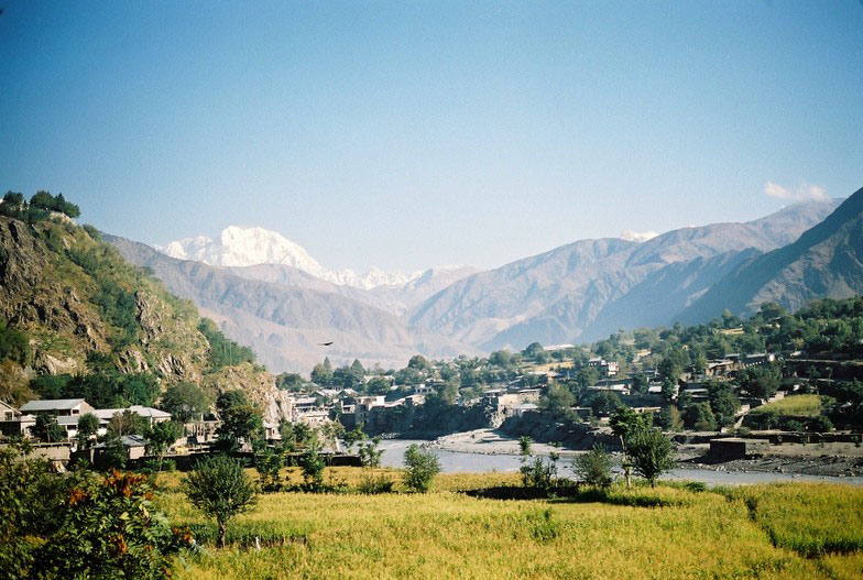
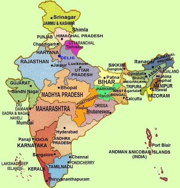
.jpg)
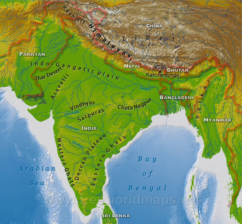
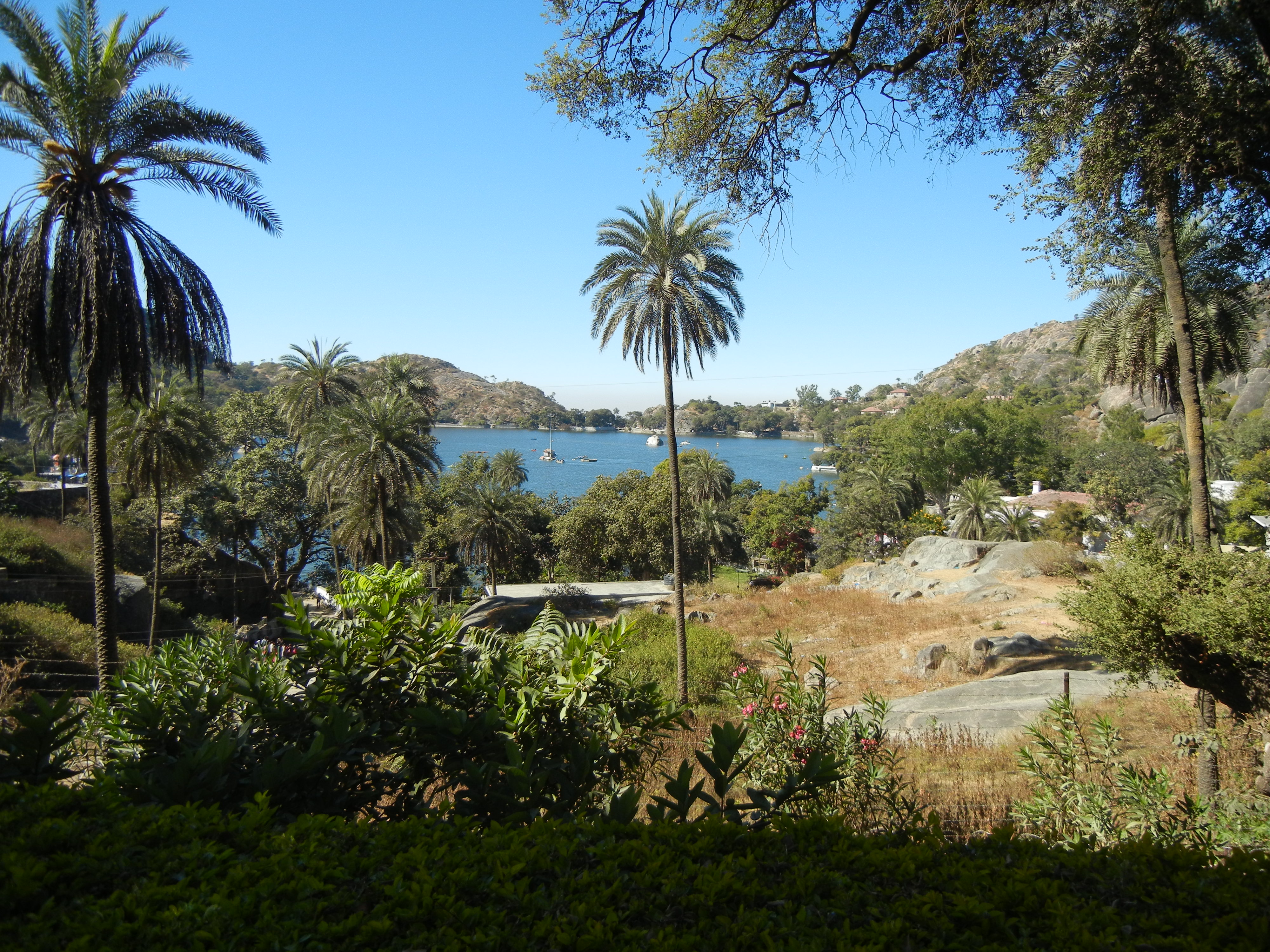